A
key element in understanding the gardens at Hanwell is having an
accurate set of plans recording all the main features which in the
initial stages at least consist primarily of earthworks. An overall
survey of the park was begun in January 2013 at a scale of 1: 400, a
slightly awkward scale to work with but one which enables us to fit
individual elements of the site onto a manageable sheet of A2 drawing
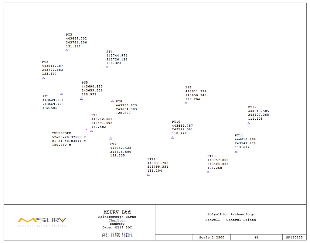
film. The framework for the survey is a series of fixed points
established by a combination of GPS and theodolite readings thanks to
the good offices of a local company Msurv.
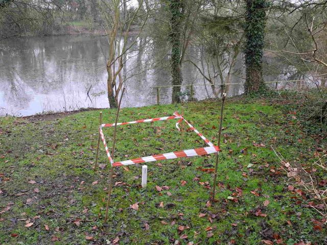
The fixed points start out as simple wooden pegs with a central nail to mark the exact point and hang tape measures onto. Eventually some of these may be converted to more permanent markers possibly set in concrete. Above is fixed point 1.
The fixed points start out as simple wooden pegs with a central nail to mark the exact point and hang tape measures onto. Eventually some of these may be converted to more permanent markers possibly set in concrete. Above is fixed point 1.
From
then on we adopt a rather more low-tech solution which consists largely
in manipulating tape measures. The most common technique is to stretch
out a tape between two of the fixed points then measure at
right angles to certain key points. This is known as off-setting and is largely done by eye
although other methods are available (see below). Alternatively for
greater precision or sometimes when awkward trees are in the way
triangulation may also be used (see below again.)
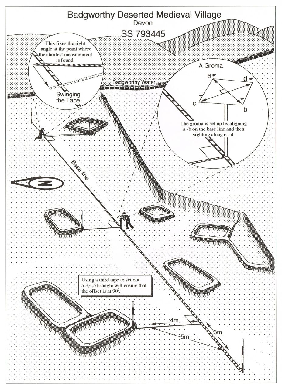
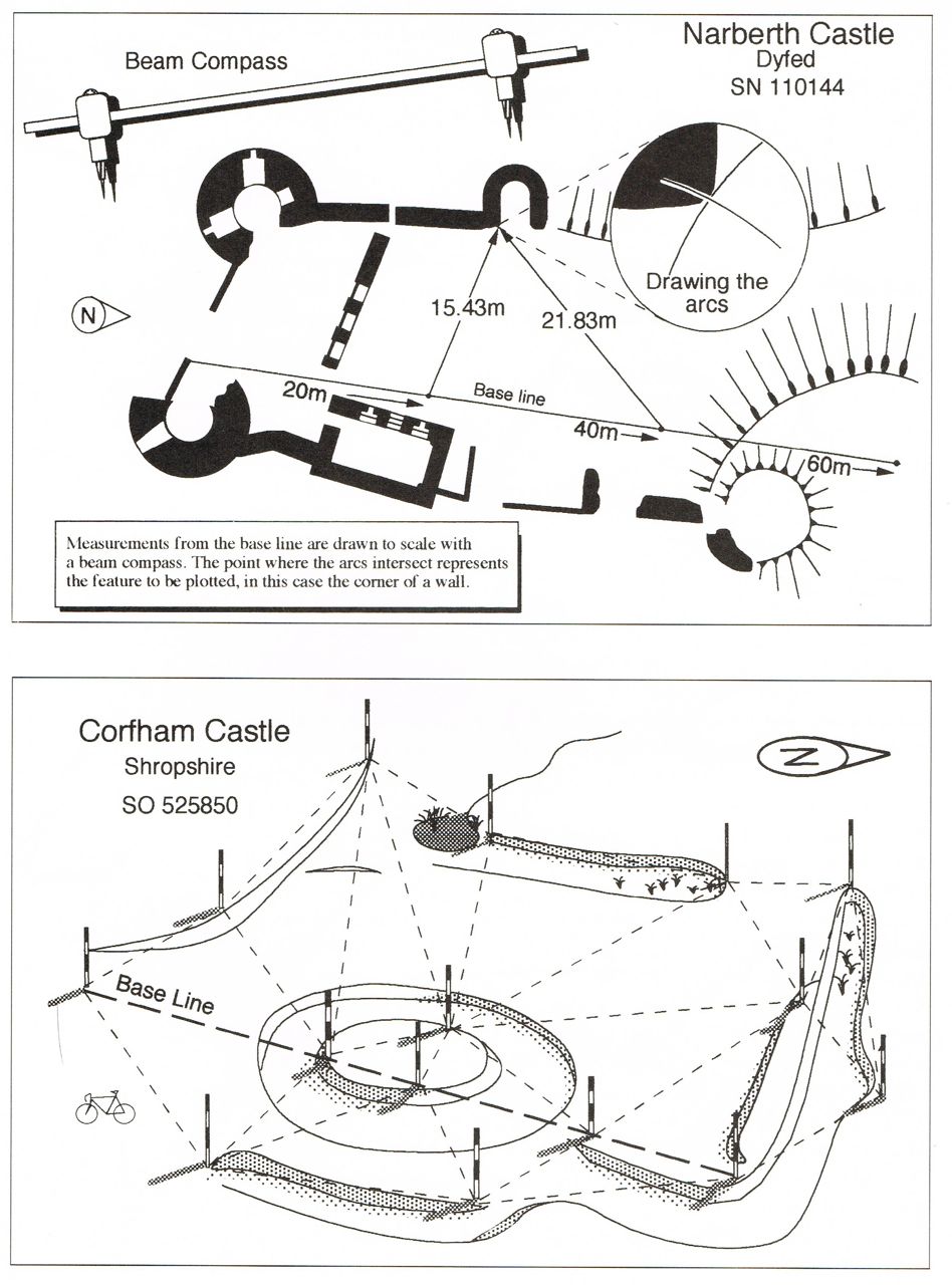
Methods for planning with tape measures (Wass 1992: 67 - 68)
Methods for planning with tape measures (Wass 1992: 67 - 68)
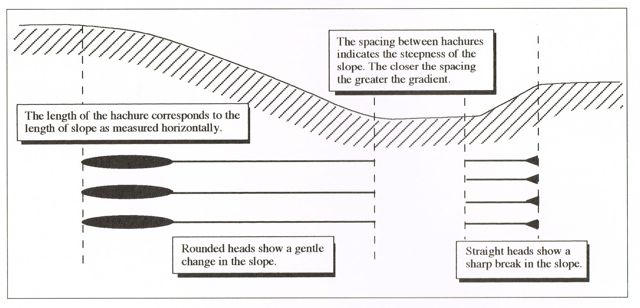
The
same planning conventions are used throughout and here is an
explanation for anyone not familiar with the wonderful world of
hachures....
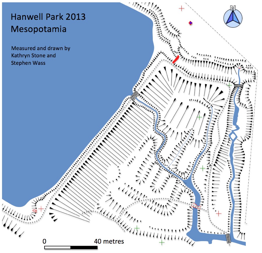
The first area to be tackled was around the Lake. The environs are marked by a complex series of terraces, especially on the north side and there is also, of course, the great dam to the east. Much of the work was done in freezing temperatures with snow on the ground. We also had to be quite inventive in fixing the position of the island on account of the profusion of trees lining the Lake. Some areas, especially around the north-east corner will be subject to a more detailed plan at a much larger scale later in the project. One question which is immediatley raised by this is why is the island not in the centre of the Lake? Could it possily have been lined up with some other feature in the garden perhaps to the south?
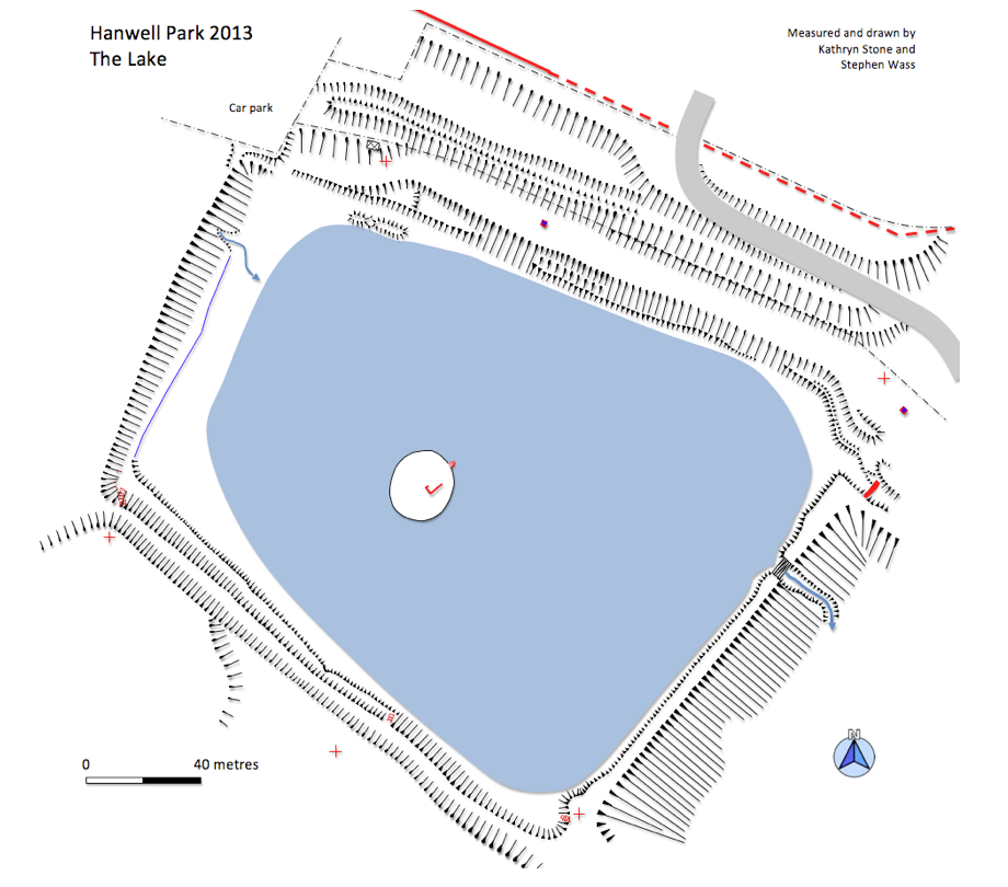
The first area to be tackled was around the Lake. The environs are marked by a complex series of terraces, especially on the north side and there is also, of course, the great dam to the east. Much of the work was done in freezing temperatures with snow on the ground. We also had to be quite inventive in fixing the position of the island on account of the profusion of trees lining the Lake. Some areas, especially around the north-east corner will be subject to a more detailed plan at a much larger scale later in the project. One question which is immediatley raised by this is why is the island not in the centre of the Lake? Could it possily have been lined up with some other feature in the garden perhaps to the south?