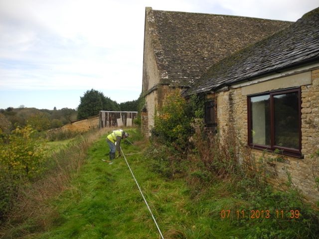
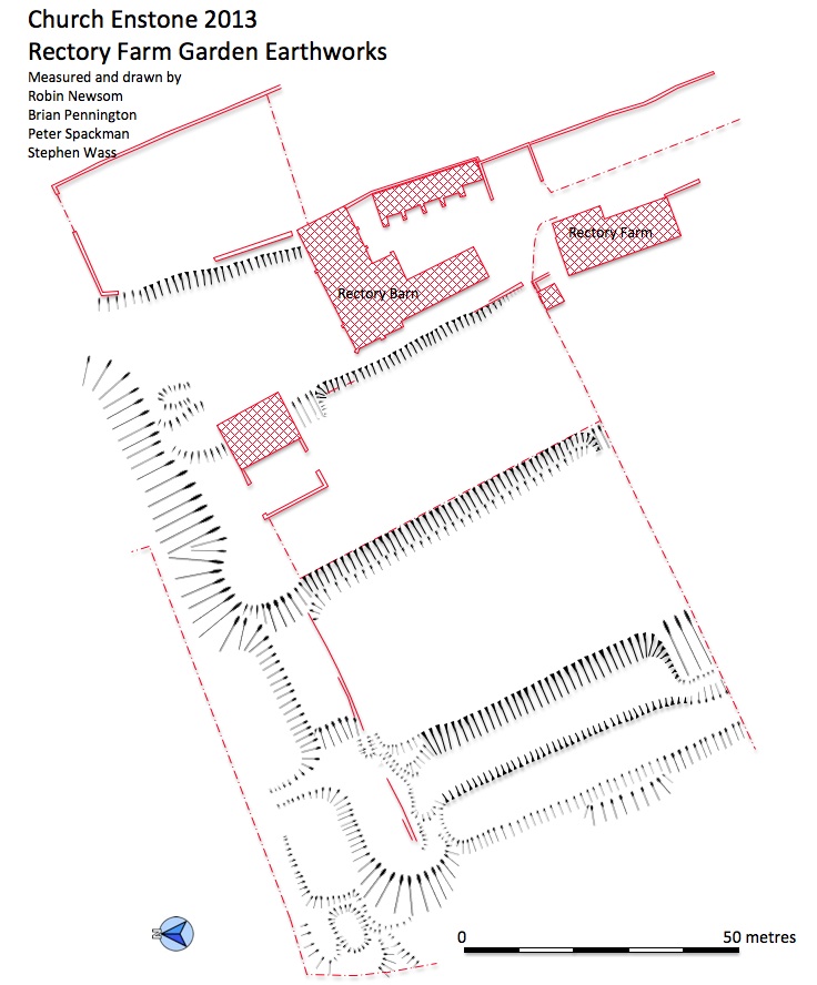
The first base-line goes down next to the barn. Part of the revetment wall peeking out from the undergrowth and a ramp that terminates the north end. Measuring across the canal.
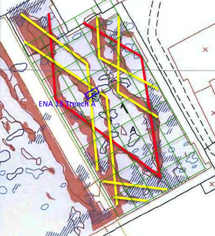
Geophysics plot by Bartlett-Clark Consultancy overlaid with possible layout of parterre.
(Shading in red represents results from resistivity whilst the blue markings are magnetic anomalies)
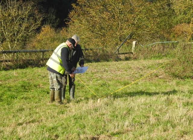
During the week that followed I spent
some time studying the remarkable results of the geophysics survey
commissioned by the landowner. This clearly identified on the
upper terrace a lozenge shaped pattern which surely must reflect
surviving features from the early garden layout. Parterres with a
diamond based motif are unusual but not unknown in the seventeenth
century and although a number of different interpretations are possible I opted for one with a large central
diamond partially intersected from each side by a pair of overlapping
chevrons. Given the strength of the signals we felt it would be
productive to mark these out on the ground for further investigation.
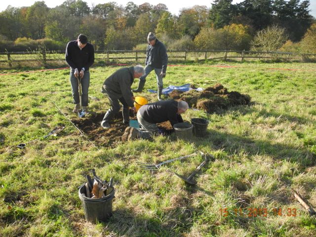
We did this with a series of wooden pegs hammered in at measured
locations and then joined together with lengths of plastic survey tape.
It looked most impressive and being able to walk amidst the pattern gave a great feel for the scale of the whole thing.
Consultation over the master plan. The last line goes down.
The Upper Terrace, south end looking south west... north end looking north west.
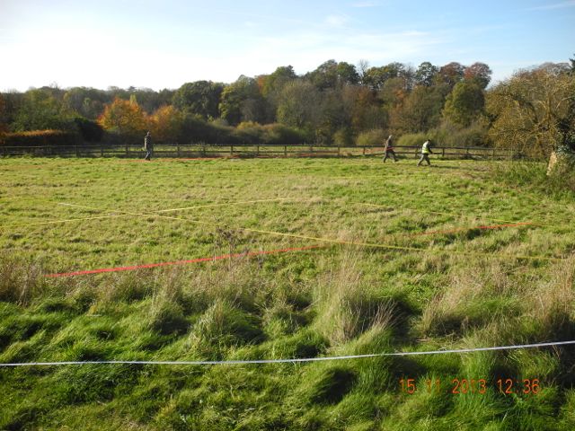
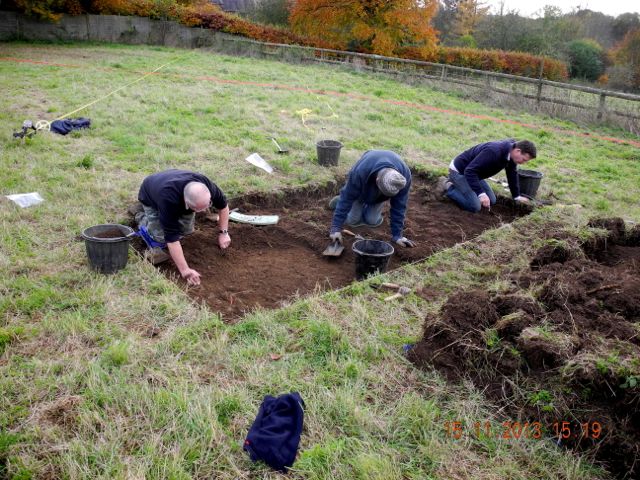
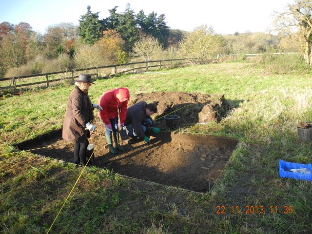
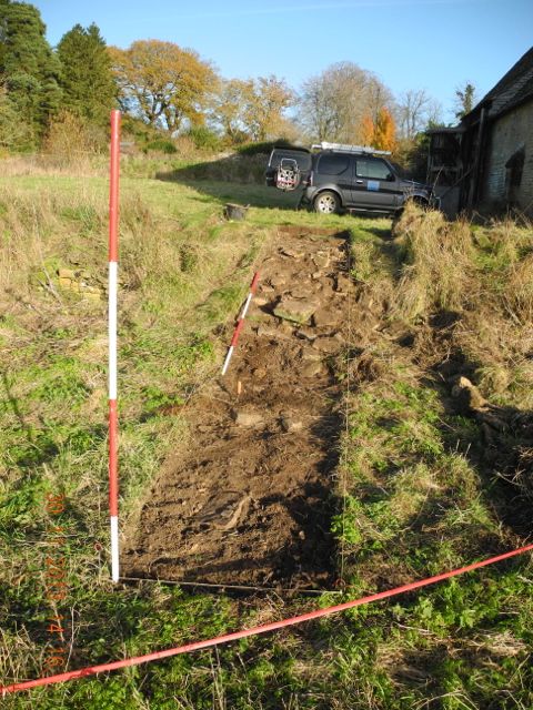
The results of this exercise were so striking we decided to move on
directly to a 2 by 4 metre evaluation trench to determine the nature of
the underlying deposits and to assess their depth and levels of
preservation. Removal of turf and topsoil to a depth of just 20
centimetres brought us down onto to surfaces composed of irregular but
level small stone slabs. These cut across the northern corners of the
trench pretty well on the lines indicated by the geophysics.
Deturfing. Removal of topsoil
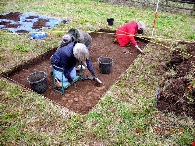

Sally, Robin and Harriet keep up the good work cleaning up on the following day.... how's that for an alignment?
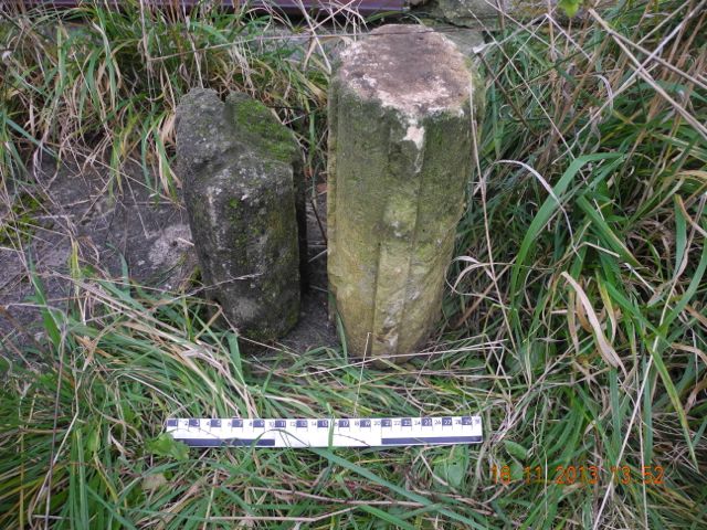
During my explorations of the site
I came across the two architectural fragments pictured below sitting on
the overgrown step of the patio door belonging to the now deserted
bungalow adjacent to the barn. These had been recovered by the
landowner
from another location closer to the barn and are clearly sections of
window mullions. What is interesting about them is that whilst both
seem to belong to a fairly major construction of the seventeenth
century they are in two different types of stone and are stylistically
quite distinct, one being broadly octagonal
in section the other being ovoid with attached rectangular section
fillets. So not only to we have evidence for a fairly impressive
building of the period close to the site but one that may have been
remodeled or extended twice during the seventeenth century.
What's on your doorstep?
Events of the first few days set me
to thinking about the overall layout of these gardens and to making
some big assumptions so here we go. Let's start with the premise that
the current Rectory Farm House was the location of a slightly larger
great house of the seventeenth century which in turn occupied the site
of an earlier medieval house associated with the Abbey of Winchcombe
and the marvelous tithe barn. We'll look at the evidence for this in
due course but just bear with me for now. The existing garden remains
are strikingly asymmetric with the terraces and canal running roughly
north to south and the garden bounded on its northern limit by our
grand stairway. Now there's evidence that the canal at least extended
much further south but exactly how far? Today it stops against the
narrow lane that runs down to the mill but what happens if we assume
the house stood at a mid-point in the garden which was symmetrical
about it. It is an easy matter to project to the south of the house an
equal area of garden and bound it further to the south with a second
monumental stairway. What's interesting about this is that it brings us
precisely in line with the current main road through the village indeed
it's striking the way in which the parallel lane down from the church
bends round to the south as if to avoid passing through the garden.
What is more telling is that there is some evidence for a terraced ramp
in the field adjacent to the main road. Not as well defined as that to
the north but certainly something worth investigating. So there you are
not even a theory yet, a conjecture perhaps, but certainly something to
think about and perhaps use to inform future research.
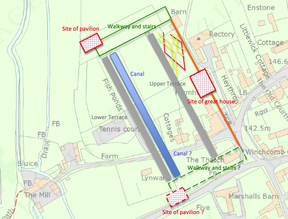
Gazing through an archaeological crystal ball.... a possible reconstruction plan of the gardens around Rectory Farm.
So with all this in mind here's
another big leap. If the gardens here were laid out by Thomas Bushell
it seems likely that he would nave paid some attention to the desiderata set out by his late patron
Sir Francis Bacon. In this connection it is interesting read in his
essay published 1625, 'Of Gardens' that
Bacon favoured a layout with
'the main garden in the middle, besides alleys on both sides' or to
elaborate, 'Also I understand, that this square of the garden, should
not be the whole breadth of the ground, but to leave, on either side,
ground enough for diversity of side alleys, unto which the two covert
alleys of the green may deliver you. But there must be no alleys with
hedges at either end of this great enclosure: not at the hither end,
for letting your prospect upon this fair hedge from the green, nor at
the further end, for letting your prospect from the hedge, through the
arches upon the heath. ' The latter point seems to describe the
situation regarding the walkway and the view to the north. and finally
concerning the width of these walks, 'alleys enough for four to walk
abreast'.
Actually thinking about the very fine small fragments of glass that have come up in the dig it is also worth quoting his advice that there should be, 'over every space between the arches, some other little figure, with broad plates of round coloured glass, gilt, for the sun to play upon.'
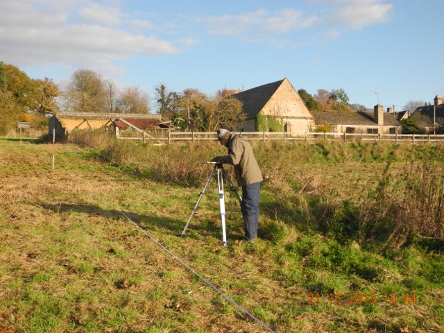
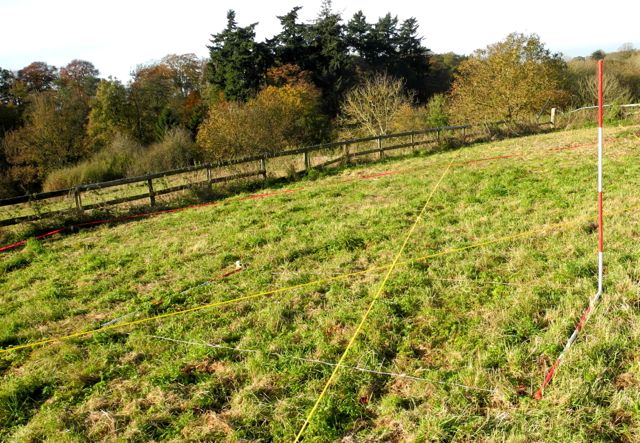
Robin plots and Peter and Brian brave the transit of the fishpond.
On the subject of the playful sun we continued to enjoy remarkably fine weather well into November. This enabled us to make great strides with the surveying, completing the plan on the stairway, or alley as perhaps we should call it now, and also using the optical level and staff to draw a couple of profiles right across the terraces and down the length of the stairs. A special thanks top Peter, Brian and Robin for this. the small area we have open to examine the results of the geophysics is producing some interesting features although as I have been reminded some of them can only be seen with that special 'eye of faith' that all archaeologists are endowed with.
Actually thinking about the very fine small fragments of glass that have come up in the dig it is also worth quoting his advice that there should be, 'over every space between the arches, some other little figure, with broad plates of round coloured glass, gilt, for the sun to play upon.'
Robin plots and Peter and Brian brave the transit of the fishpond.
On the subject of the playful sun we continued to enjoy remarkably fine weather well into November. This enabled us to make great strides with the surveying, completing the plan on the stairway, or alley as perhaps we should call it now, and also using the optical level and staff to draw a couple of profiles right across the terraces and down the length of the stairs. A special thanks top Peter, Brian and Robin for this. the small area we have open to examine the results of the geophysics is producing some interesting features although as I have been reminded some of them can only be seen with that special 'eye of faith' that all archaeologists are endowed with.
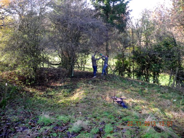
Verna directs Sophie and Nick and Nick (again) and Robin (again) start to clear some undergrowth from the sunken feature on the the north west corner of the main garden.
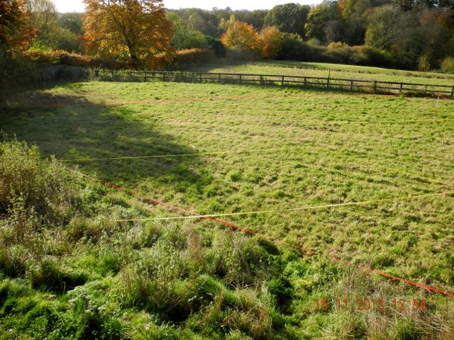
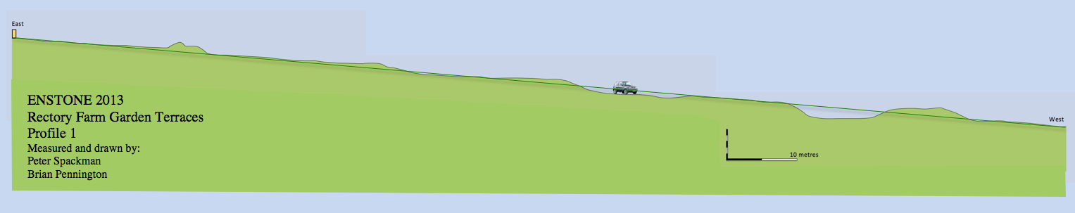
And here is one of the fruits of the massive leveling exercise that Peter organised: a composite view across the entire width of the garden with four terraces and a fishpond/canal. The green line represents, roughly, the natural fall of the land making it easy to see how a process of cut and fill has been used to shape the landscape.
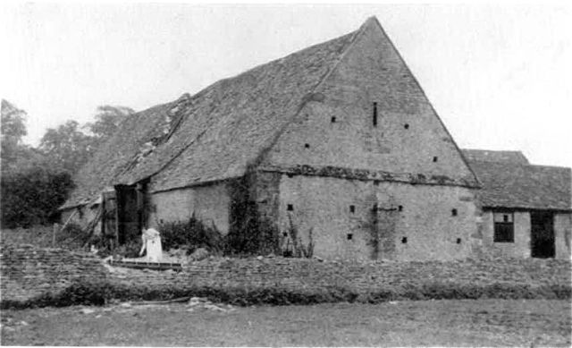
Rectory barn from the west, photo early 20th. century?
As November drew to a close we set
out a metre wide section across the bank on the upper
terrace next to the barn. An early photograph (see above) shows the wall
to be substantially intact although there seems to have been something
of a collapse in front of where the woman is apparently feeding
chickens. It's difficult to know what to make of the material which
seems to be lying behind this collapse. Given the importance of this
wall in defining what may be the boundary between the ornamental and
working parts of the garden one might expect it to have had some
architectural pretensions, crowned by a balustrade perhaps. Anyway the
plan is to clear the collapsed rubble and hopefully recover any early
portions of walling and examine how the base of the wall interacts with
the original garden surface.
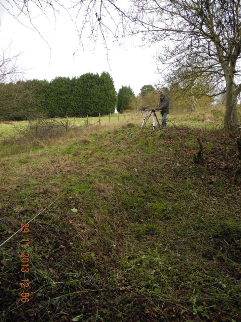
Another task we have just about completed is the earthwork survey with some more clearance of blackthorn down on the north west corner. Robin and I planned the curious little terrace and associated sunken area. It will, of course, take some time to convert these field sketches into a publishable plan but we'll try and get that done before the end of the year. There is clearly something very significant going on here and I've modified the reconstructed plan (above) with the suggestion that this may be the site of a garden pavilion of some kind, a feature which was often to be found marking the corners of formal gardens of this type.
Another task we have just about completed is the earthwork survey with some more clearance of blackthorn down on the north west corner. Robin and I planned the curious little terrace and associated sunken area. It will, of course, take some time to convert these field sketches into a publishable plan but we'll try and get that done before the end of the year. There is clearly something very significant going on here and I've modified the reconstructed plan (above) with the suggestion that this may be the site of a garden pavilion of some kind, a feature which was often to be found marking the corners of formal gardens of this type.
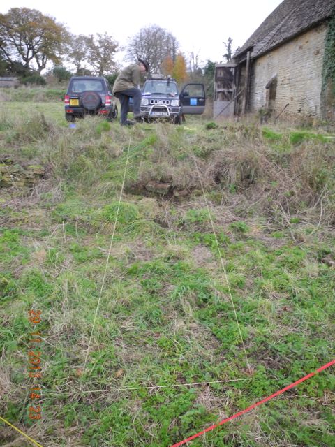
Bryan starts to remove the turf from the new section and after a couple of days we can see the extent of the collapsed wall. Meanwhile Robin is plotting down below.
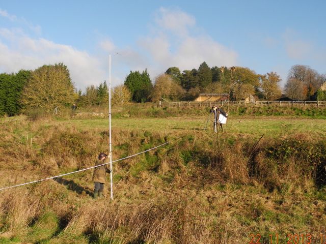
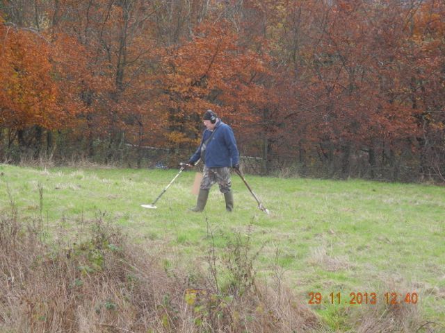
Peter began a metal detector survey of the terraces for us by systematically walking the area
and plotting the positions of significant signals. Investigations have
yet to turn up anything of great significance but there's more to do.
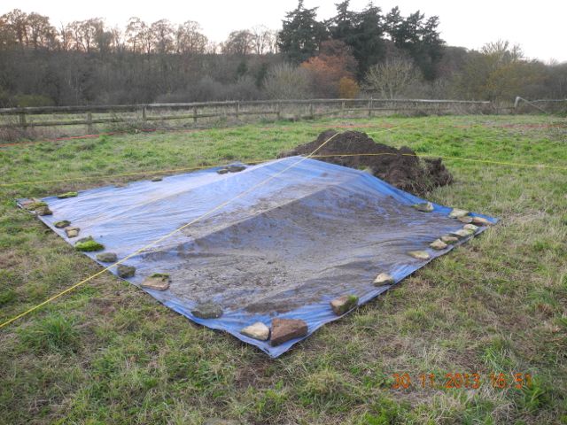
As December will see our attentions concentrated elsewhere we closed
the site up until the new year erecting a suitable cover over the main
trench where I'm convinced there is a lot more to be discovered
given some very careful excavation in January.
Peter strides out. All tucked up for Christmas.
Now to be honest
the next part of the process shaded over into December but who's
counting? The earthwork survey of Nick's section of garden was drawn
out and here it is. This is a reduction of the original drawing so some
detail is lost but it is interesting to note the bastion like feature
half way down the walkway. Such echoes of the military life were quite
common features of gardens from the period. Also visible are the
various earthworks on the north-west corner which are clearly part of
significant structure.
I've also been
in correspondence with James Bond who will be known to many of you for
his many contributions to work in landscape archaeology in Oxfordshire and elsewhere. He reminded me of the important
garden earthworks on the site of Chipping Campden House, a property
destroyed during the Civil War but developed during the opening years
of the seventeenth century. Although the Campden example is on a larger
scale ( the owner, the wonderfully named Sir Baptist Hickes was really
very wealthy) stylistically they share many features and clearly belong
to a common tradition of design.
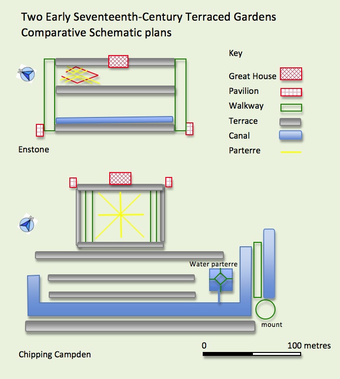
They are both built as terraced gardens with the accompanying stream broadly speaking to the south. They are strongly symmetric although some irregularity was introduced into the Campden plan with the construction of a water garden, additional canal and mount to the east. Interestingly in early images of the gardens dating from the 18th. century but presumably derived from an earlier illustration the illusion of symmetry is maintained by the addition of a second water feature on the western side. Both gardens feature walkways or viewing terraces as side alleys to the formal gardens and both have terracing which is used to strongly model the natural fall of the ground. The formal parts of the gardens are predictably adjacent to the great houses and other buildings are distributed symmetrically, at least we hope that's the case for Enstone. Finally the lower limit of the garden is defined by a canal. Actually there's another feature I've just noticed, the strong axis through the garden and house also aligns in both cases with the parish church, now I don't normally get terribly excited over alignments, they are too easy to fabricate, but this does feel a touch significant.
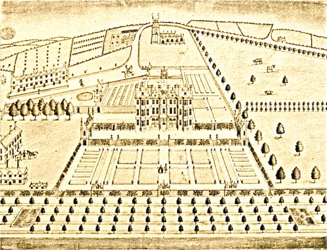
A slightly idealized drawing of Chipping Campden House and gardens from the 1740s, nevertheless an interesting pointer towards the layout at Enstone.
Of course we do not know at present who was responsible for the design of the Enstone gardens, whether it was the incumbent Lee family or whether it happened during Bushell's period as leaseholder but one does wonder what if any contacts there may have been between two fairly close neighbours, Chipping Campden is about 16 miles from Enstone.as the crow flies.
They are both built as terraced gardens with the accompanying stream broadly speaking to the south. They are strongly symmetric although some irregularity was introduced into the Campden plan with the construction of a water garden, additional canal and mount to the east. Interestingly in early images of the gardens dating from the 18th. century but presumably derived from an earlier illustration the illusion of symmetry is maintained by the addition of a second water feature on the western side. Both gardens feature walkways or viewing terraces as side alleys to the formal gardens and both have terracing which is used to strongly model the natural fall of the ground. The formal parts of the gardens are predictably adjacent to the great houses and other buildings are distributed symmetrically, at least we hope that's the case for Enstone. Finally the lower limit of the garden is defined by a canal. Actually there's another feature I've just noticed, the strong axis through the garden and house also aligns in both cases with the parish church, now I don't normally get terribly excited over alignments, they are too easy to fabricate, but this does feel a touch significant.
A slightly idealized drawing of Chipping Campden House and gardens from the 1740s, nevertheless an interesting pointer towards the layout at Enstone.
Of course we do not know at present who was responsible for the design of the Enstone gardens, whether it was the incumbent Lee family or whether it happened during Bushell's period as leaseholder but one does wonder what if any contacts there may have been between two fairly close neighbours, Chipping Campden is about 16 miles from Enstone.as the crow flies.