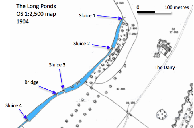
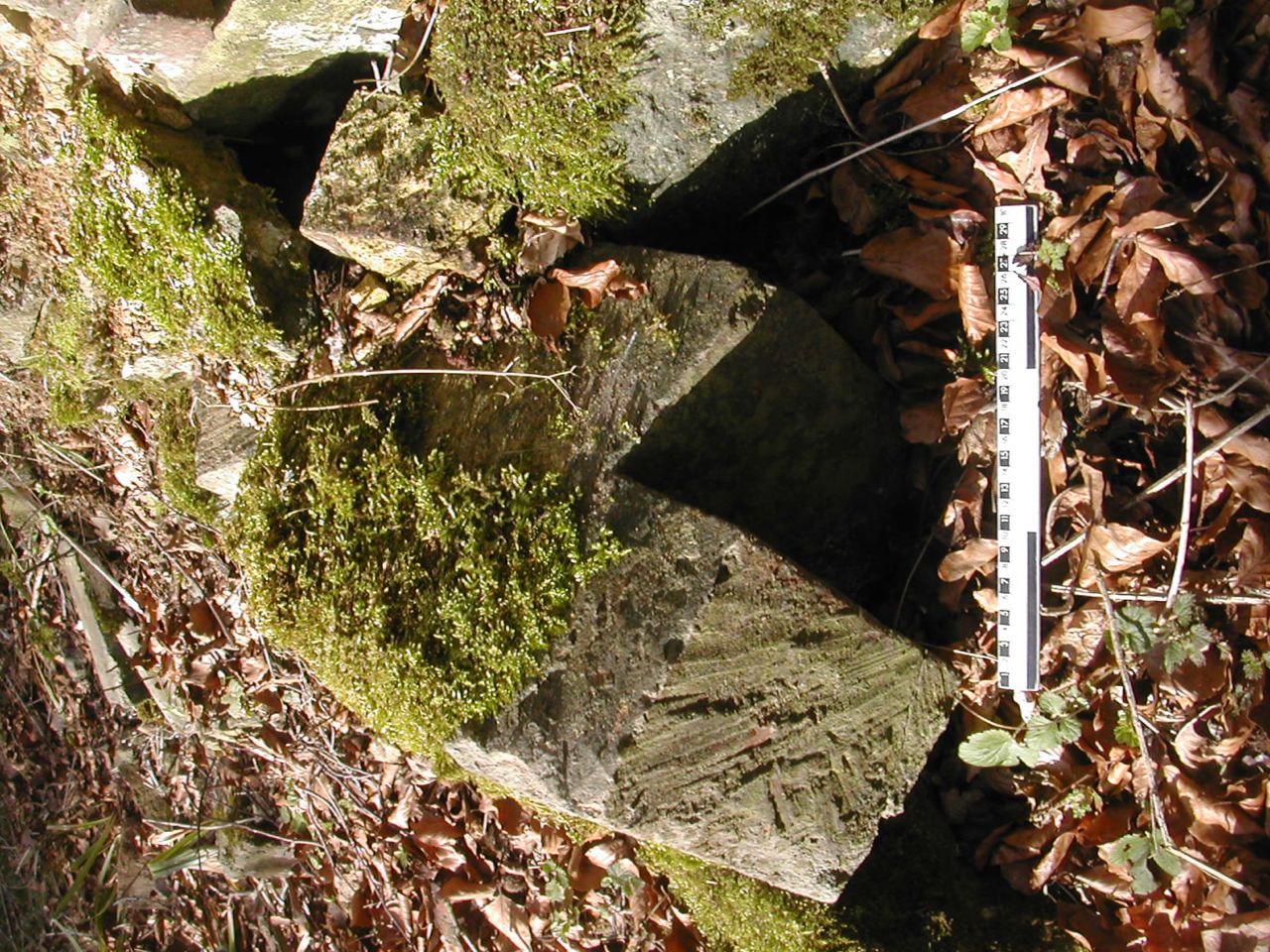
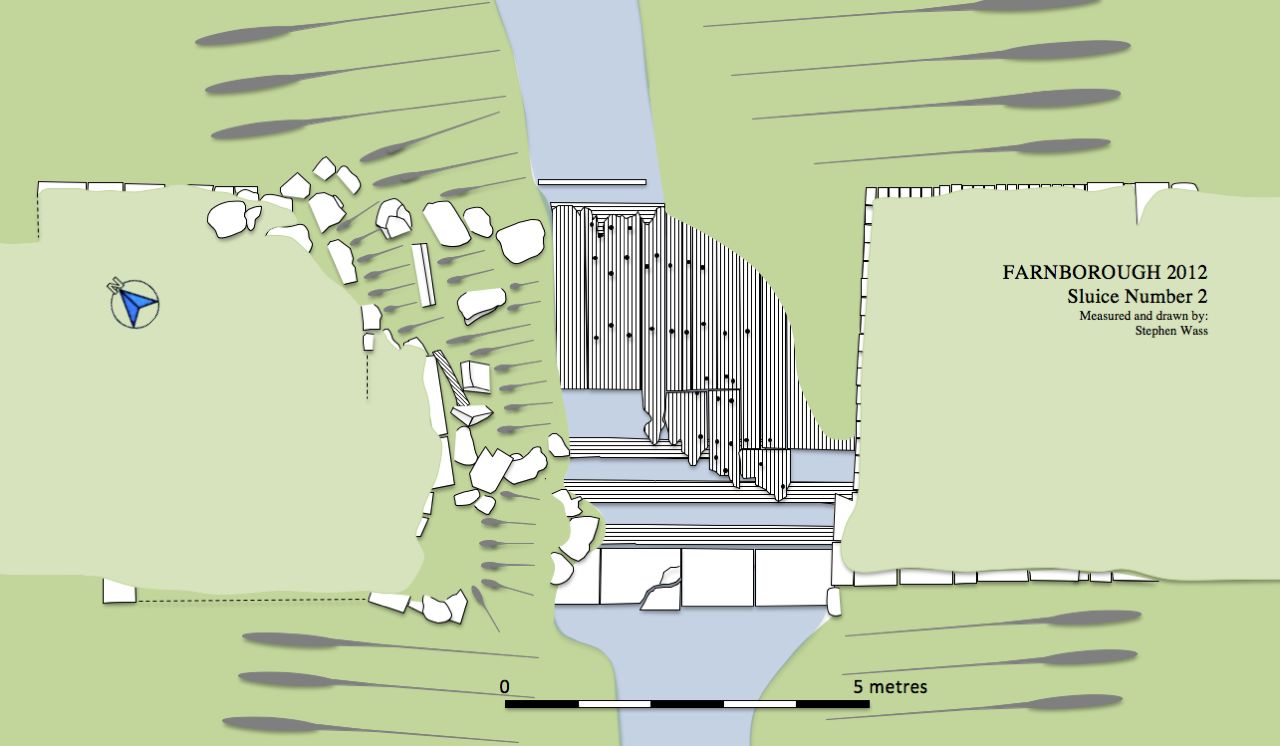
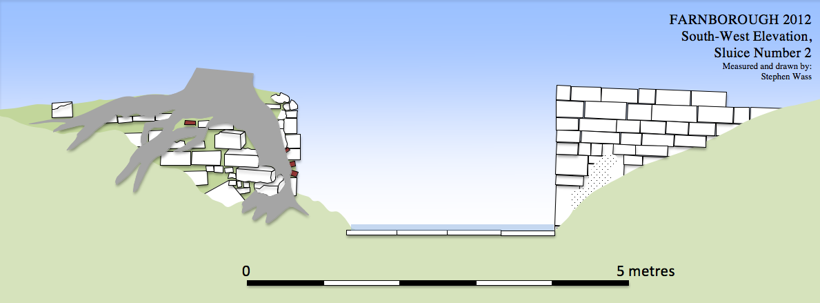
Sluice
2 has a number of interesting features: the south pier is reasonably
well preserved while the north pier is very ruinous, bits and pieces
ate scattered around amongst the rubble such as an iron grid and
because of the flow of the water it was possible to clear some of the
bottom to reveal details of timber boarding. Like all the sluices the
angled rebates survive which enabled the sluice gates to close against
each other whilst presenting a shallow 'prow' pointing up stream.
Sluice 2, general view from west Sluice 2, north pier from east
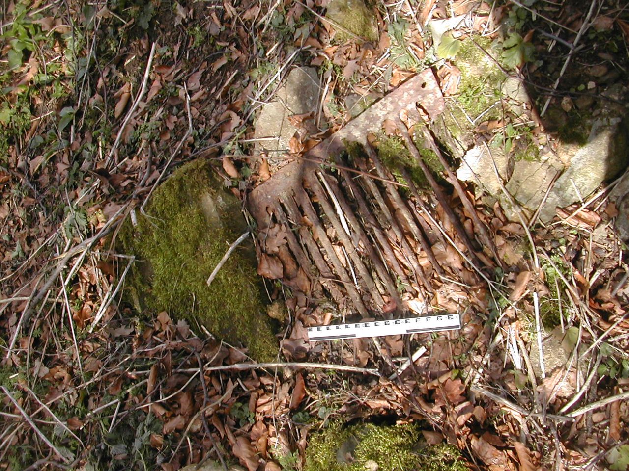
Sluice 2, angles rebate for gate Sluice 2, iron grid
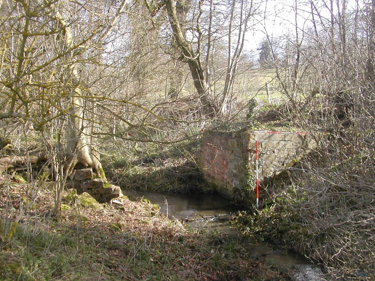
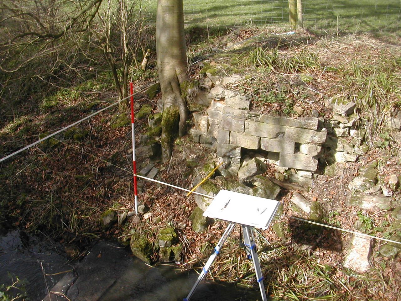
Sluice three is in some ways the best preserved with some very nice stonework showing on the down stream face, presumably because up stream the fabric would be mostly underwater. Like all the sluices it is built from a mixture of brick and dressed stone and shows evidence of at least two phases of building.
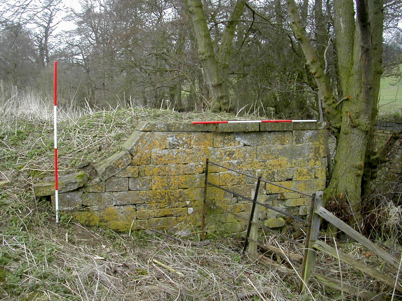
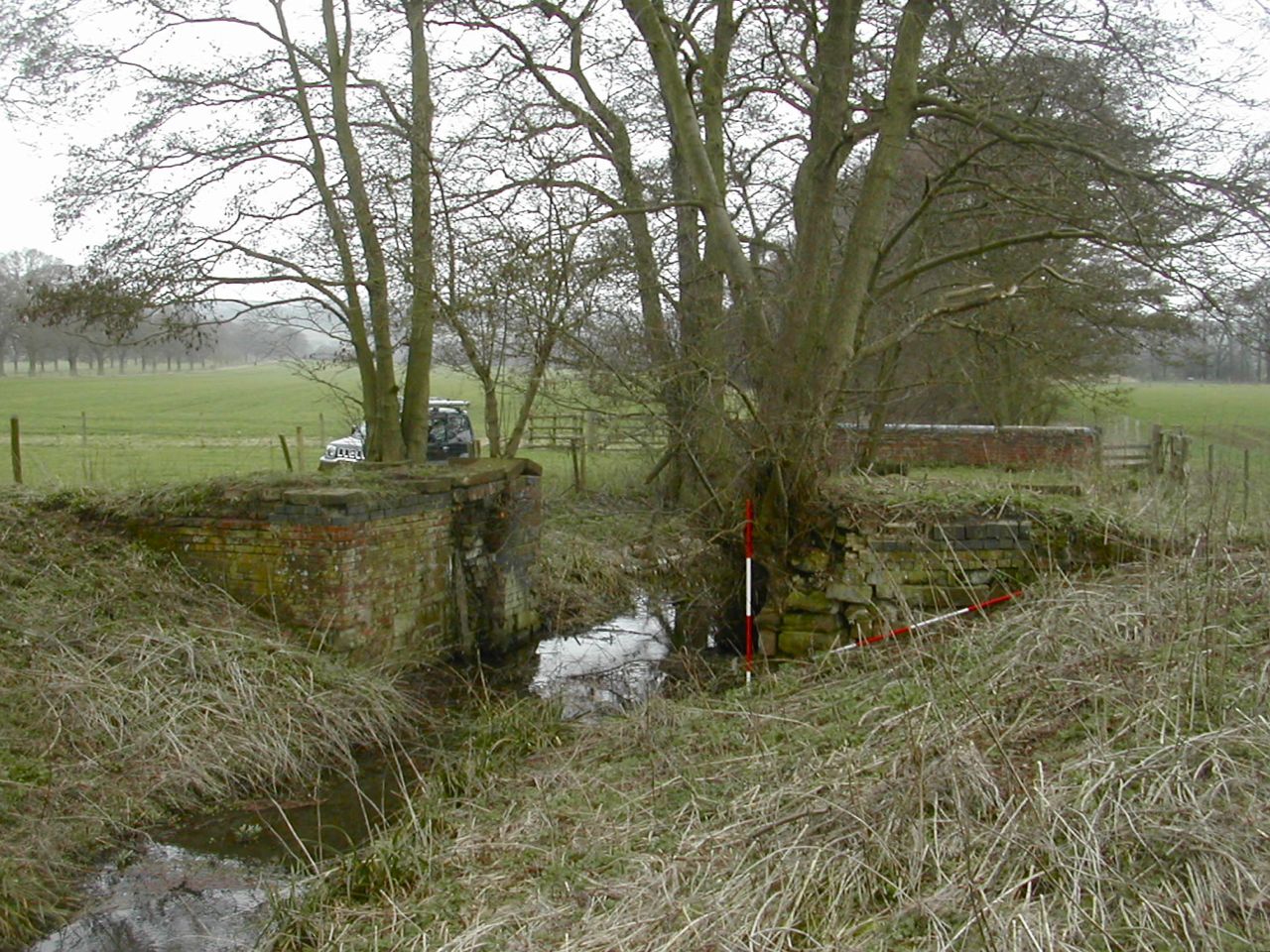
Sluice 3, north pier from the west (down stream) Sluice 3, general view from the north east (up stream)
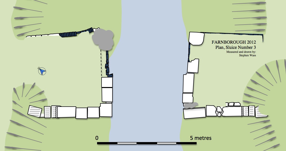
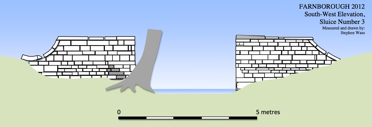
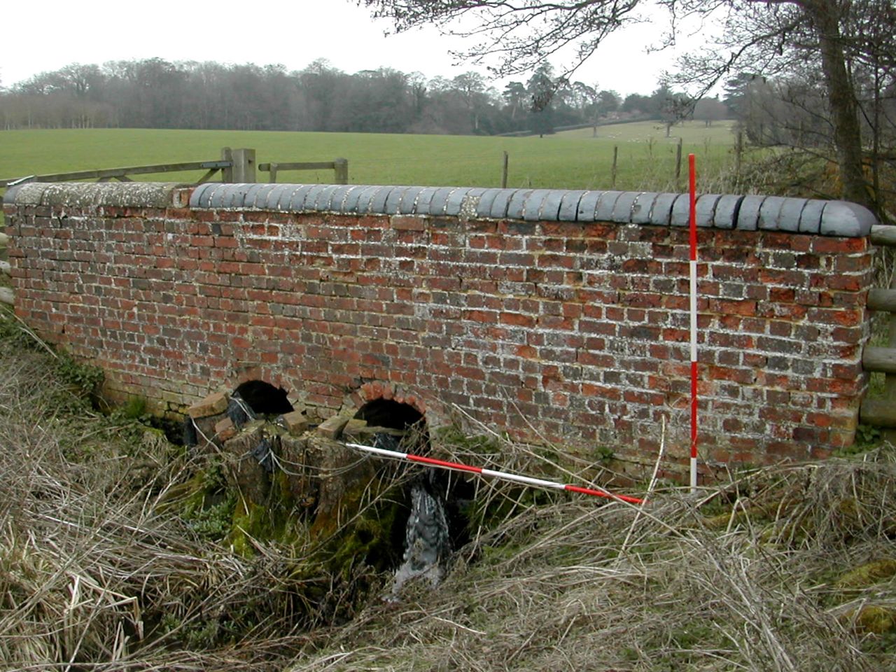
The bridge a few metres down stream from sluice 3
Sluice 2, general view from west Sluice 2, north pier from east
Sluice 2, angles rebate for gate Sluice 2, iron grid
Sluice three is in some ways the best preserved with some very nice stonework showing on the down stream face, presumably because up stream the fabric would be mostly underwater. Like all the sluices it is built from a mixture of brick and dressed stone and shows evidence of at least two phases of building.
Sluice 3, north pier from the west (down stream) Sluice 3, general view from the north east (up stream)
The bridge a few metres down stream from sluice 3
I
only came across sluice four rather late in the day and a real
nightmare it is proving to be. I had to clear a lot of undergrowth,
including some particularly nasty briars and the whole thing,as well as
being the largest construction is also in an especially parlous state.
The planning process is proceeding quite slowly and cautiously. However
this sluice shows the best evidence for a least three periods of
rebuilding, the latter most seeing the original timber gates replaced
with a solid concrete block, now partially broken through, which echoed
the original configuration. The outer face of the north pier has a
particularly alarming lean to it.
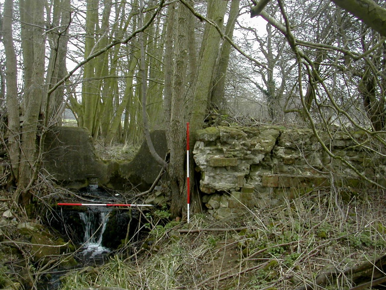
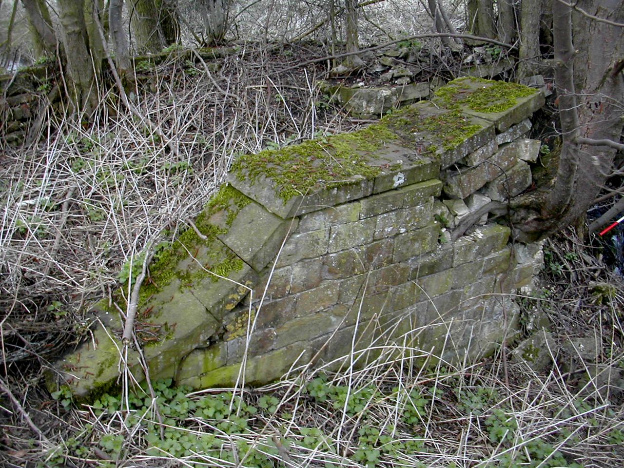
Sluice 4, view from south -west Sluice 4, north pier, south-west face
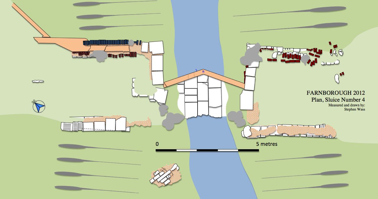
Sluice 4 Plan
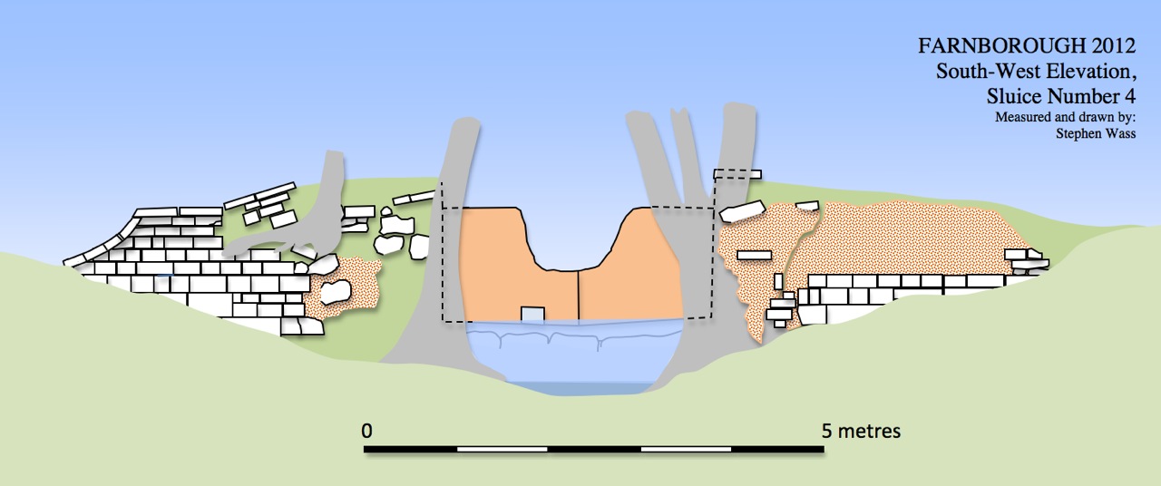
Sluice 4 elevation
Sluice 4, view from south -west Sluice 4, north pier, south-west face
Sluice 4 Plan
Sluice 4 elevation
And
then of course exploring further downstream there are a series of works
known locally as the old sheep wash which seem to be about managing the
confluence of two streams and creating a triangular pool at the very
end of the Serpentine River. This will be even trickier to draw!
Apart from the work outlined above I've also started traipsing round the country to examine other garden amphitheatres to get some ideas about how ours was used. Towards the end of March we dropped in on the gardens at Chiswick House - all very interesting.