The Farnborough Park Project
March / April 2011
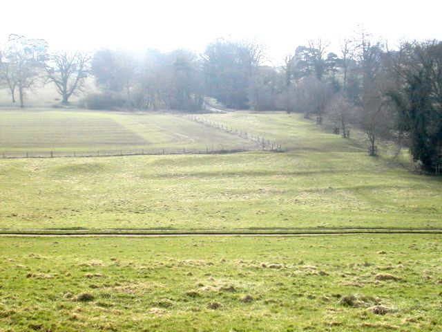
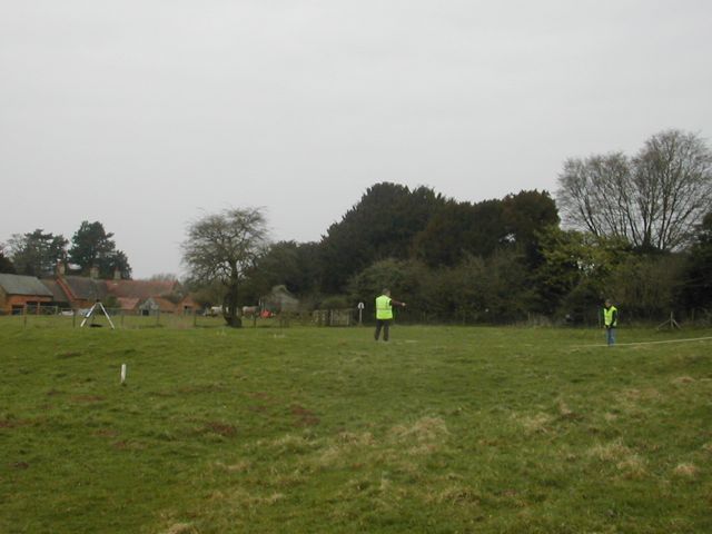
Field work began with earthwork surveys in the field known as Church Oakal which lies south of the church. We defined two sites: A, in the valley bottom consisting of banks, terraces and a feature which in plan resembles a small medieval homestead moat with attached fishpond; B, on the hill top where we planned several house platforms and a series of well defined garden terraces. We looked next at the bridge which carries the road from Banbury down to the village. This structure was cleared of undergrowth and detailed plan and elevations drawn of the bridge itself and associated recent garden features including a rockery and a series of drains some of which we believe to be pre-eighteenth century. Finally an area to the south of the B site designated C was planned. Although there are some curious regularities in this part of the site we are currently interpreting the earthworks here as the remains of stone quarrying.
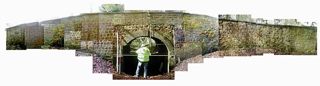
Elevation drawing at the bridge, east face looking west - photomontage
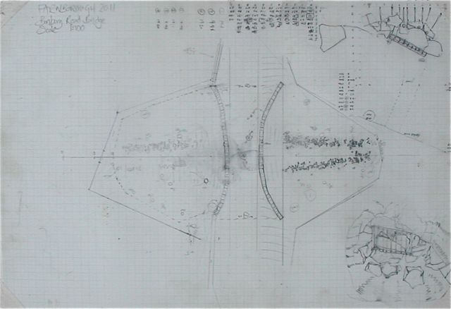
Working drawings from the Bridge
Field work began with earthwork surveys in the field known as Church Oakal which lies south of the church. We defined two sites: A, in the valley bottom consisting of banks, terraces and a feature which in plan resembles a small medieval homestead moat with attached fishpond; B, on the hill top where we planned several house platforms and a series of well defined garden terraces. We looked next at the bridge which carries the road from Banbury down to the village. This structure was cleared of undergrowth and detailed plan and elevations drawn of the bridge itself and associated recent garden features including a rockery and a series of drains some of which we believe to be pre-eighteenth century. Finally an area to the south of the B site designated C was planned. Although there are some curious regularities in this part of the site we are currently interpreting the earthworks here as the remains of stone quarrying.
Valley
bottom A site with earthworks from the north
Survey work at
Church Oakal B site
Elevation drawing at the bridge, east face looking west - photomontage
We
started to investigate the arrangements for water management
around the park including drains. This outfall lies to the north west
of the bridge and following the clearance of the undergrowth revealed
itself to be of two periods. On the right we had the base,
side and part of the curving roof of a stone lined drain which
had been cut into and replaced by a brick lined culvert at a lower
level. The roof of the culvert has collapsed for something like 1.5
metres back from the opening into Island Pool. Analysing features like
these will enable us to discuss changes
to water levels.
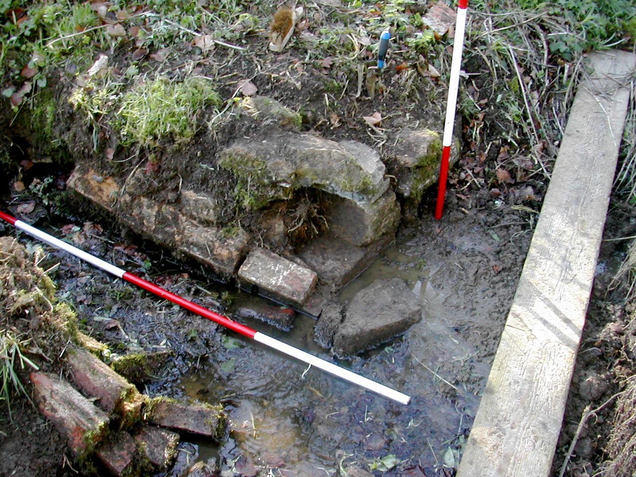
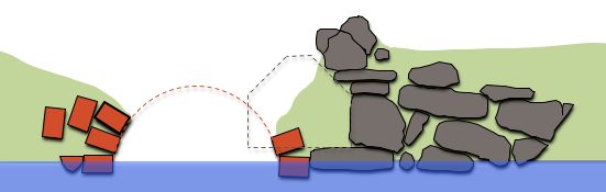
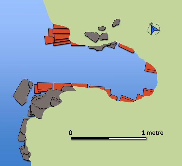
The Paddock - Drain 1
Photograph from NW, elevation and plan
The Paddock - Drain 1
Photograph from NW, elevation and plan
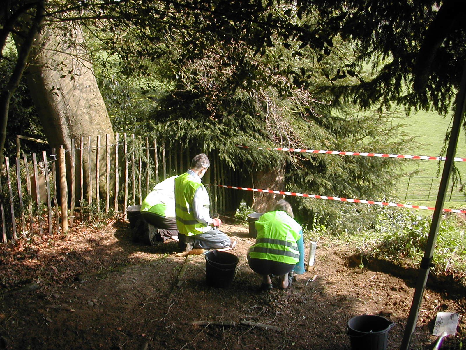
On
Wednesday April 20th. we transferred our attentions to the top of the
cascade. The intention was to fully record this important eighteenth
century landscape feature as well as investigating the possible
association with the site of an earlier water mill. However, our first
step was to re-excavate the site of a summer house on the rise above
the cascade. Local informants tell us this was dug some time between 10
and 15 years ago and initially we were unable to discover who by or
find any
published record of the site. A volunteer visiting the park in October
2011 recollected helping clear the site some time around 1996 under the
direction of the, now deceased, former head gardener. He did not recall
any archaeological involvement. We were able to clear the remains
fairly
easily and are planned the site stone by stone!
It was a marathon piece of drawing and visitors were able to see the
work underway when the house was open on Saturday and Wednesday
afternoons for much of the summer.
The remains as revealed consisted of a large roughly square cobbled area defined by two concentric squares marked with stone slabs. Stone slabs are also set along the diagonals as an additional decorative feature. Evidence of a post socket on one corner suggested four posts supporting a pyramidical thatched roof, perhaps with overhanging eaves and open sides. We did not have a date for this structure but we are hoping that future documentary research will throw some light on this new addition to Farnborough's monuments.
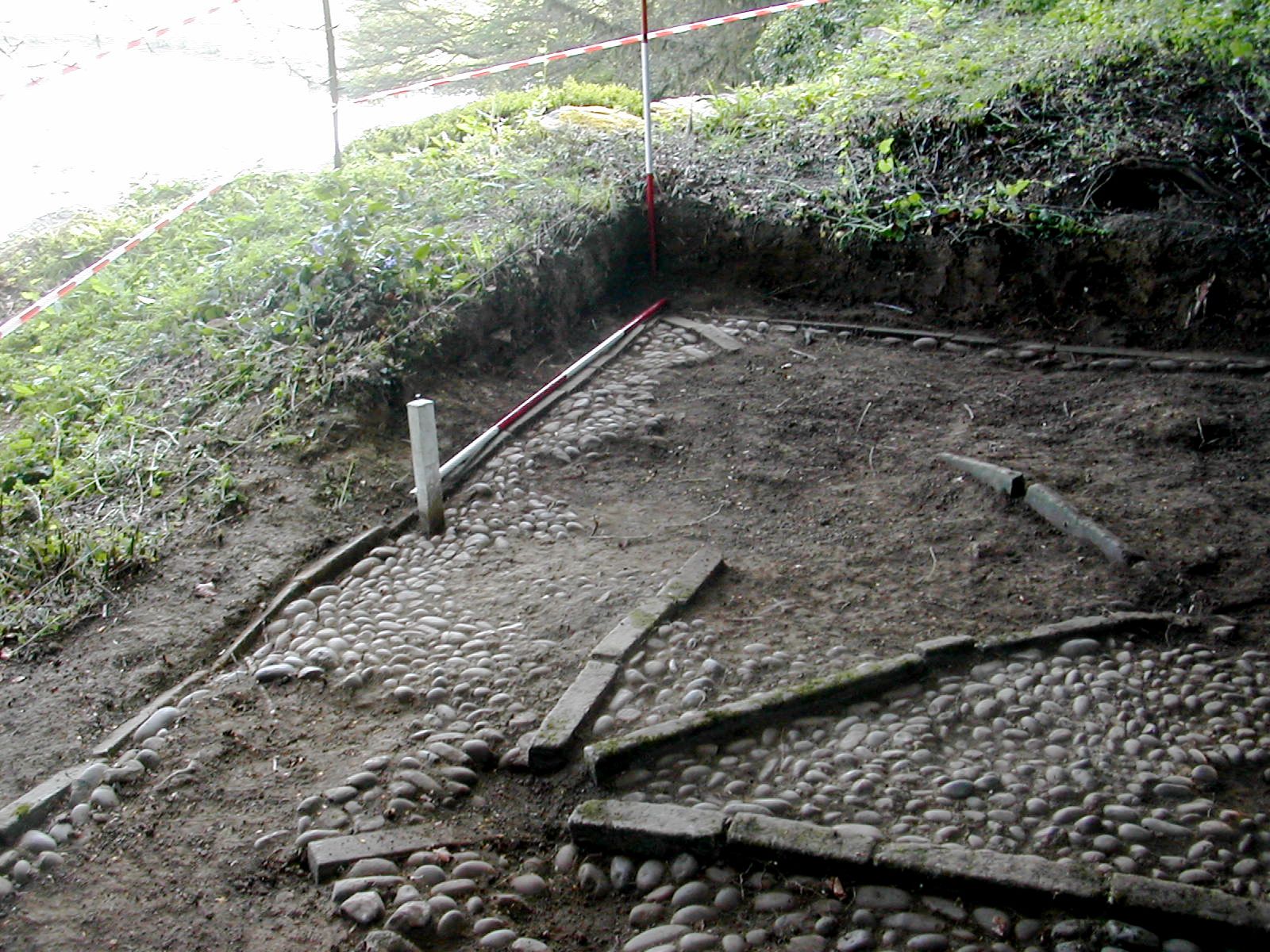
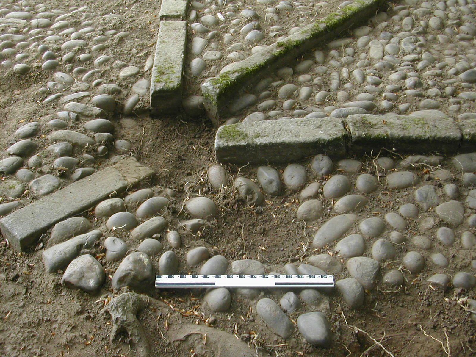
The dig starts The south corner uncovered Close up of post setting
The remains as revealed consisted of a large roughly square cobbled area defined by two concentric squares marked with stone slabs. Stone slabs are also set along the diagonals as an additional decorative feature. Evidence of a post socket on one corner suggested four posts supporting a pyramidical thatched roof, perhaps with overhanging eaves and open sides. We did not have a date for this structure but we are hoping that future documentary research will throw some light on this new addition to Farnborough's monuments.
The dig starts The south corner uncovered Close up of post setting