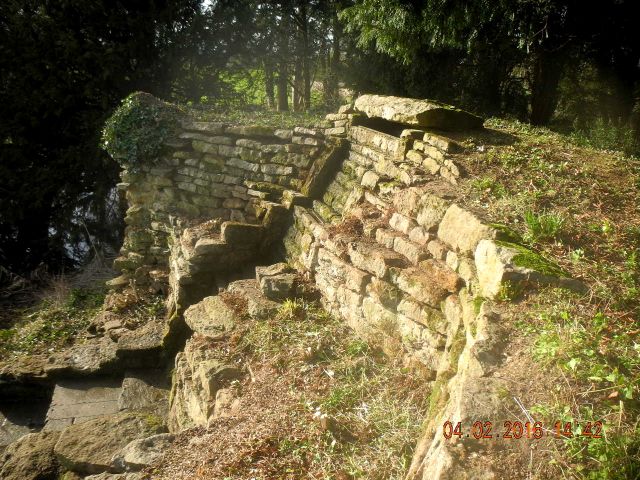
The Cascade following the clearance of the top of the mound and as much ivy as we could safely remove from the dodgy corner.
The first week of February
saw some astonishingly mild weather, the southward facing cascade is a
real sun trap and warms up rapidly, hence to attraction to snakes I
guess. Much of our time was devoted to further ground clearance: more
ivy stripping and lots of weeding. A special word of thanks to Richard
for using his strimmer and pole saw to get at those difficult to reach
collections of ivy and bramble and to his team of volunteers for
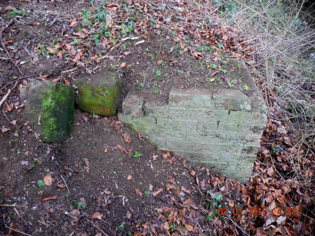
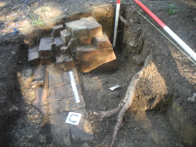
carting away all the debris. We also set to work re-excavating (for the
second time ) the cobble and stone foundations of a gazebo or
summerhouse. You can read the account of our first re-excavation here.
Apart from making the site tidy the fact that the surface had weathered
significantly over the past four years meant that new features emerged
as we cleaned back, especially interesting were the lime mortar
settings for the edging stones which we hadn't seen before.
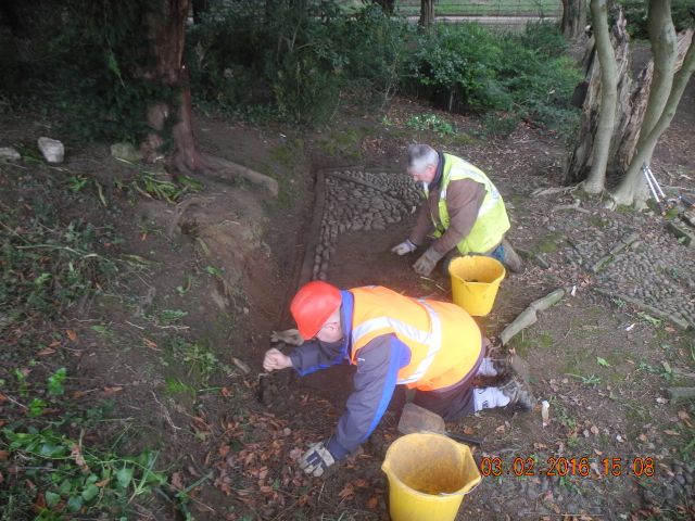
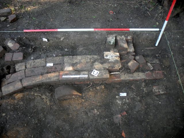
Peter and Geoff set to work re cleaning the cobbles... 'oh do we have
to?'
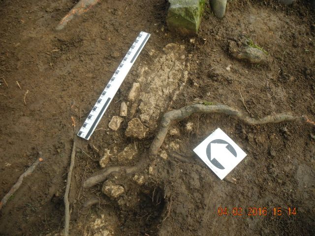
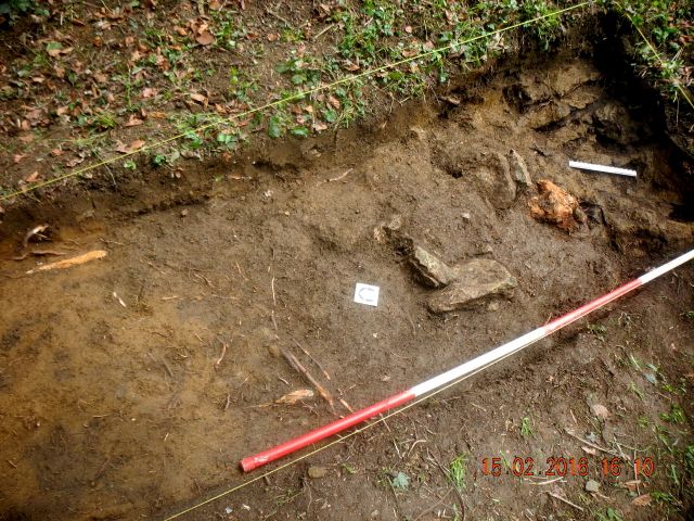
A meticulous piece of digging by Peter, the fractured remains of lime
mortar bedding.
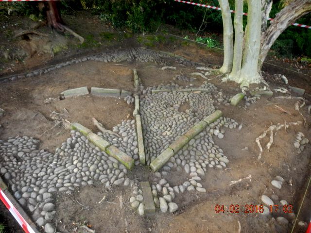
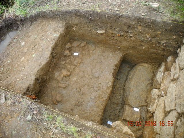
And the finished product - all spick and span, now all we have to do is keep it clean for the next few months.
Our brief at
Farnborough is to help develop an understanding of the cascade itself:
how it was built and maintained, but another important strand is to
determine how it was used and seen within the context of the immediate
landscape. To help with this we need to trace the course of any related
walling and pathways and will be agreeing the location and size of a
series of small scale trenches to help with this. As a first step we
undertook, yes, you guessed it, more weeding. I was particularly
interested in the brick abutments of a footbridge shown on early OS
maps but not on the 1772 estate map. Once cleared off the one on the
far side incorporated some interested chamfered stone blocks. On the
Cascade side of the channel there must have been a flight of steps to
take the pathway up behind the mound, something for us to investigate.
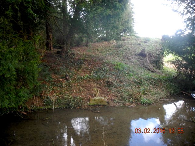
Two sides of the non-existent foot bridge: on the far bank with brick and stone and behind the Cascade looking for steps.
F
ollowing a
conversation with the Trust's Archaeology Officer we set out three
trenches to start our investigations into the setting of the monument
with a particular brief to try and sort out questions of access,
gateways, paths, steps and what have you. It was also important to
recover some information as to how the Cascade and its mound had been
constructed and what it was all sitting on. Whilst the trenches were
marked our and started Peter completed the recording of the west wing
of the Cascade, a side we hadn't studied in detail before as it had
been wrapped in ivy.
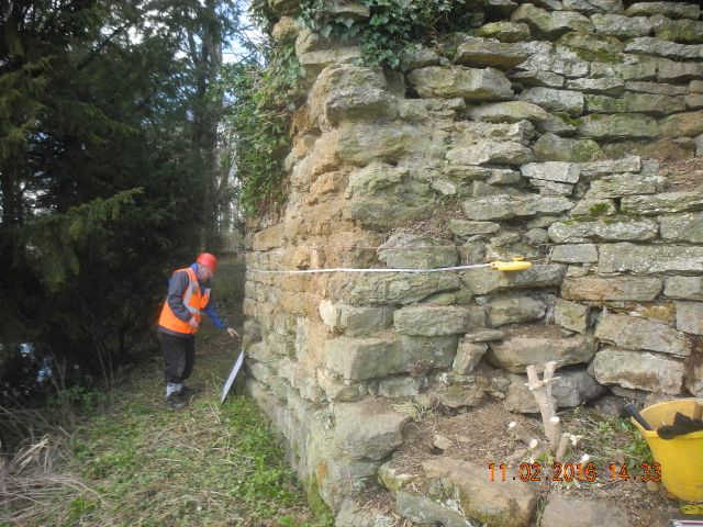

Peter sets to on the drawing of the west wall and trench C behind the
wall starts to pick out some interesting features associated with the
park wall.
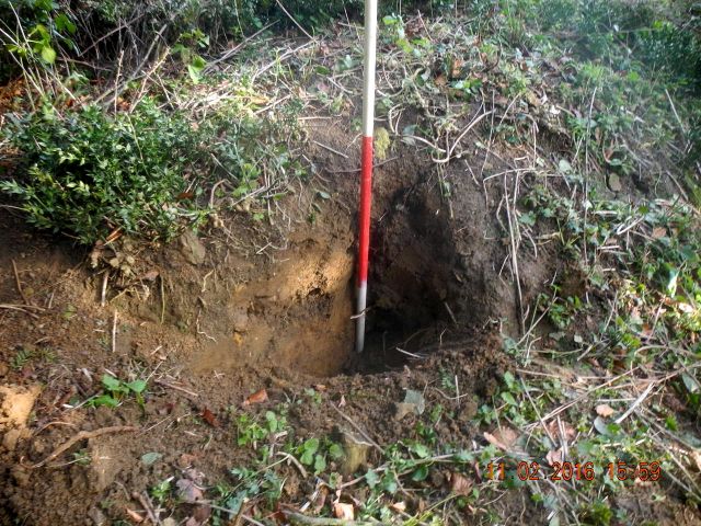
Making use of other excavators, a burrow gives us a preview of the
mound's make-up. Peter at work on Trench A...
going down.
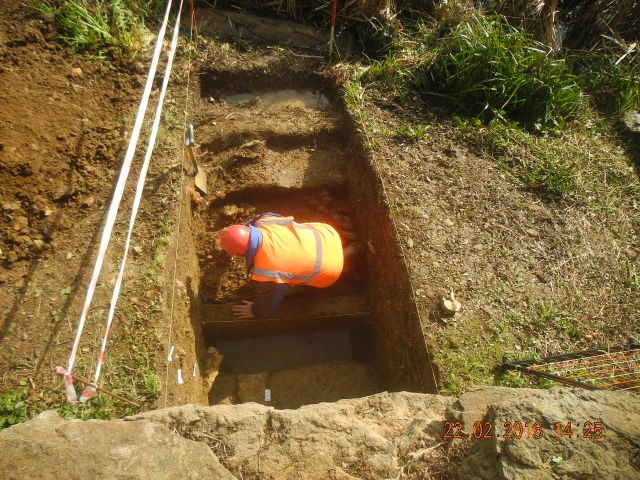
Digging began
with a trench (C) set well behind the mound. The 1772 estate map seemed
to show some kind of entry way here plus a cross wall which didn't
quite make sense and we wanted to check what was going on. However, the
most urgent task prior to the arrival of structural engineers and what
have you was to examine the foundations and substrate to the monument.
Seemed straight forward enough except that by the end of the second
week we were still going down and had uncovered over a metre's depth of
new walling much of which would originally have been exposed. There
were some traces of a bank piled up against the face of the wall made
of alternate bands of clay and sand but no foundations.... yet.
Four more courses.
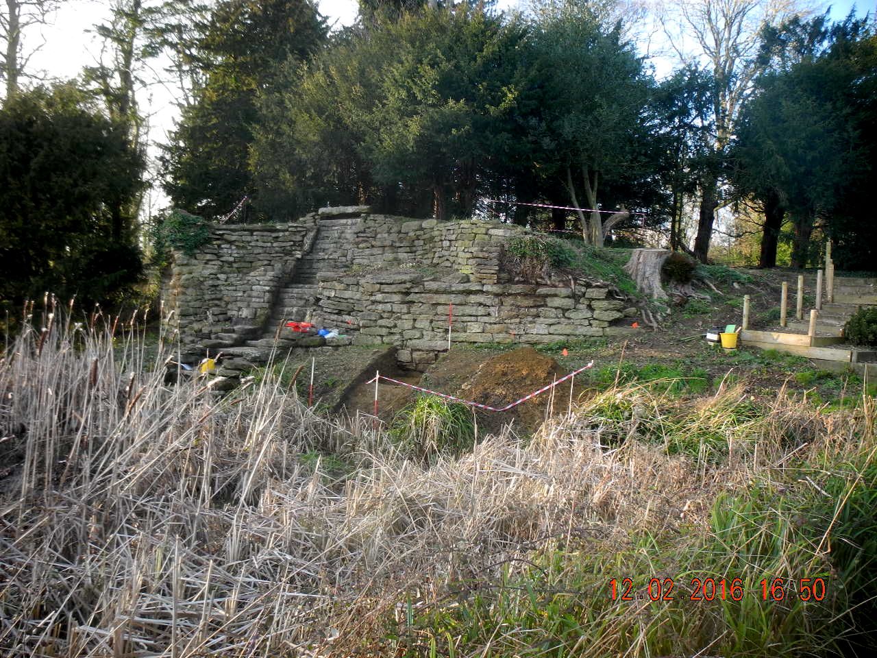
The big picture once again, if all this walling was originally exposed the monument would have had quite a different appearance.
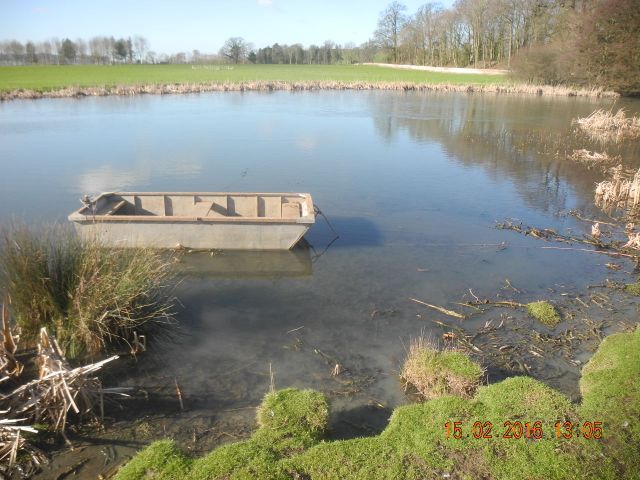
In order to
prepare for our lake bed survey and facilitate our watching brief
of the desilting with Richard's help we cleaned up the good ship 'Tin
Can' as I christened it, took it down to the River's edge by trailer
and launched it, all I need to do now is find some oars. Other wise we
were working hard to prepare for a visit from the project manager who
was going to determine what measures were necessary for the Cascade's
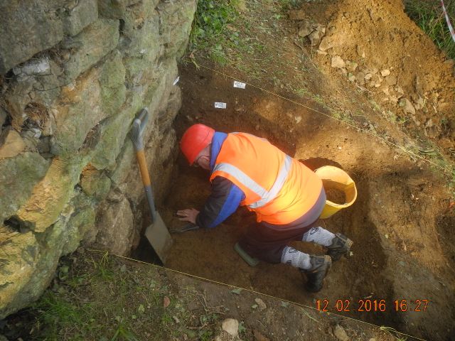
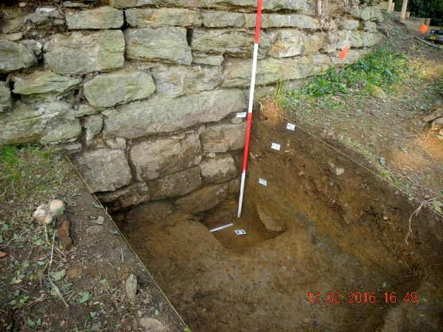
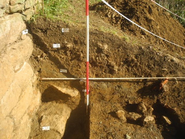
repair. Working in Trench A we eventually penetrated down to a
foundation course nearly a metre below the present ground level. As
mentioned above it looks as if there was a lot more walling showing
above ground in its original appearance. What we were less successful;
in finding was evidence of any kind of metalling for a pathway along
the front of the monument, it was always have been grassed. Meanwhile
round the back of the mound Trench D was positioned so as to pick up
traces of steps up from the footbridge, which it hasn't so far, and the
path that shows as a terrace curling up behind the mound, which it has
done. At least we have traces of a miniature holloway which will need
further examination.
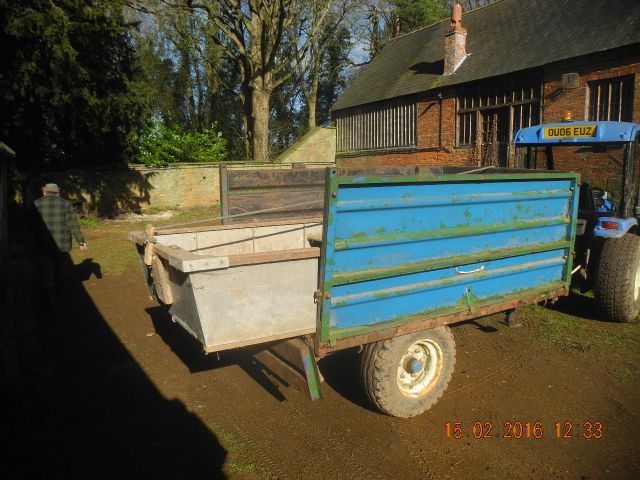
The
Tin Can, loaded and ready to go and proudly bobbing about on the waves
Trench D looking east, the pathway is marked by the strip of dark earth
running diagonally cross the trench. Trench A Foundations and other
structures to be investigated.

The Foundation course exposed. the frost shattered nature of some of the blocks indicates they were originally above the ground.
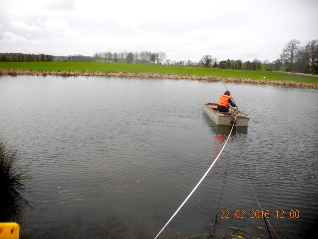
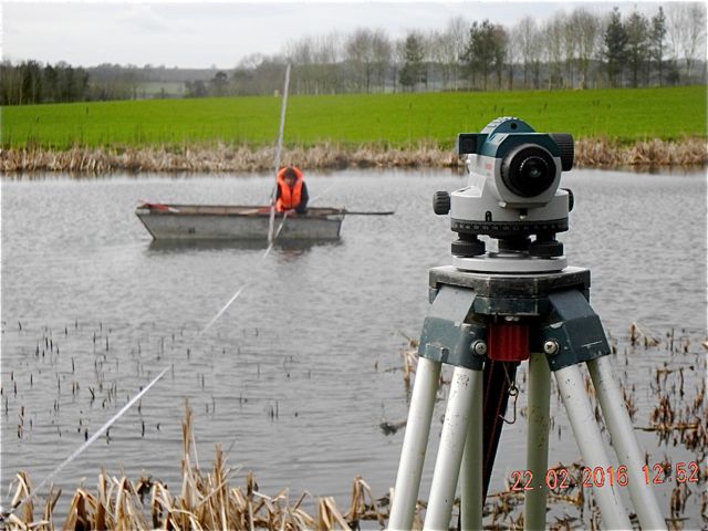
Having got the
boat launched and awaiting expectantly the arrival of the big digger we
thought it would be worthwhile to get to work on measuring the depth of
the lake and examining the deposits within it. This caused some
hilarity as various difficulties presented themselves: the trailing
rope was too short (we had to use the tape to pull ourself back with);
the paddle, and a paddler, were terribly inefficient, the head wind
blew me back as soon as the paddling stopped; on the far side we
couldn't get the boat to land so Peter had the long walk round to catch
a rope and haul it in and once back on the water as soon we had the
staff in position the boat started to drift away from it. Nevertheless
we battled on and produced the first of our lake bed profiles.
Heading out into the unknown... well actually to the other side of
pool.
Staff in place and trying to keep steady
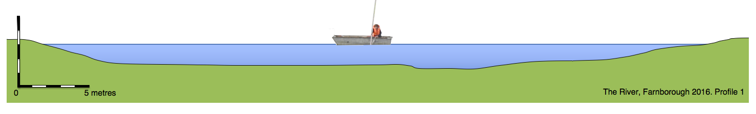
The end result.
Back on land Peter completed the
excavation in front of the cascade and unearthed the foundation course
and the substrate it was bedded on, then it was over to me to do the
recording. Up on top we also made good progress on examining the state
wa;ll at the point where we thought there may have been an entrance. As
always it turned out to be far more complicated than we imagined.
Peter in Trench A, yes there is water down
there.
All cleaned up for the section drawing.
Extraordinary structures associated with the estate wall which we assume dates from the 1740s, no real idea yet what's going on.