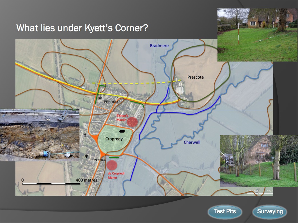
It seems likely that the original crossing to Prescote would have cut through the northern part of Cropredy hence the earthwork holloway (photo bottom right) and the possible Saxon development clustering to the south of the track which may also have been lined by ditches running eat to west (photo left) Could the development of Cropredy as a larger settlement have been fostered by the building of a bridge and causeway across the Cherwell further south? In which case was the bank at Kyett's corner (photo top right) designed to close off the the older route to divert lucrative traffic through the village and down to the new bridge? Channels have been cut (dark blue) to divert the original water courses. When was this done?