THE FISHPOOL VALLEY
PROJECT 2017
Click here to read about
2018 2019
2019 the Autumn Visit
2020 2021
Back to Projects
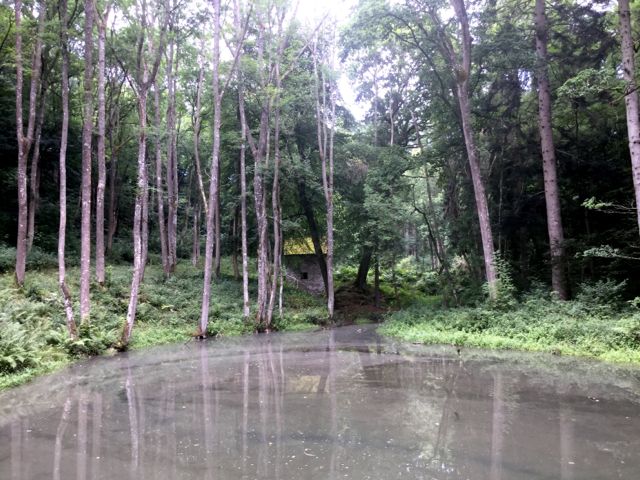
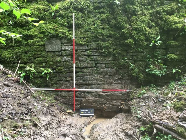
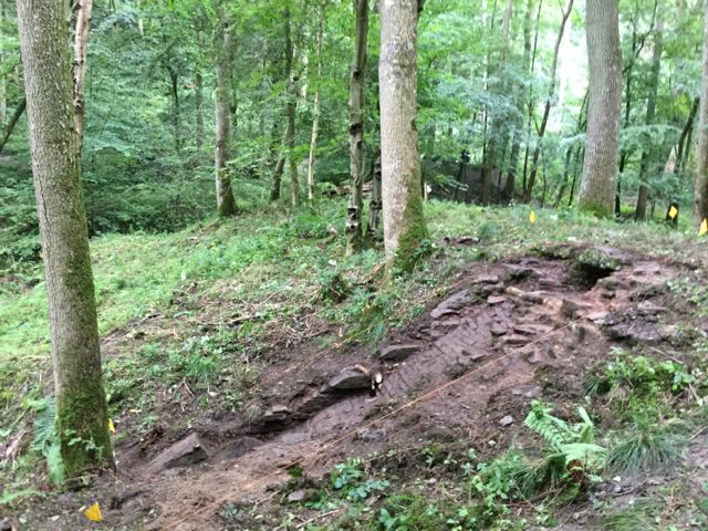
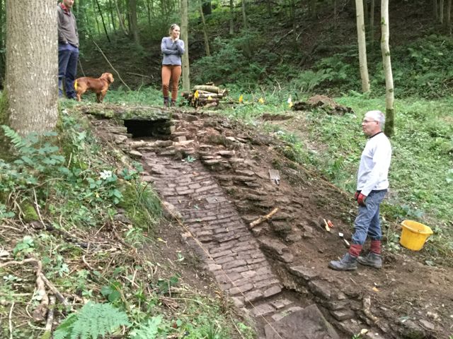
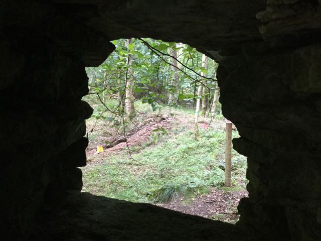
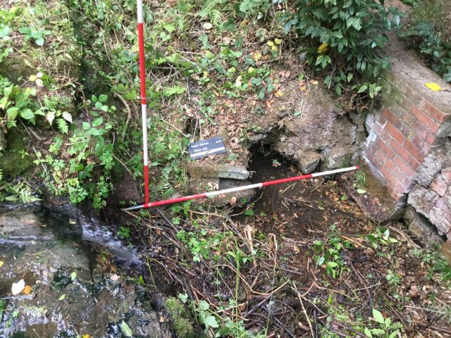
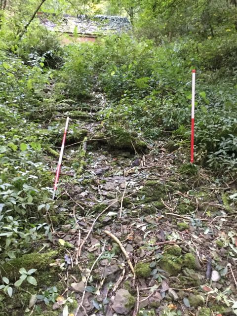
A view looking west up the valley towards the 18th. century pump house.
Click here to read about
2018 2019
2019 the Autumn Visit
2020 2021
Back to Projects
A view looking west up the valley towards the 18th. century pump house.
This project came about as the result of a need to begin major engineering work to repair and conserve a series of dams, waterways and pools in Fishpool Valley, Croft Castle, Herefordshire. The work in the park is generally thought of as dating largely to the late 18th. and early 19th. centuries and is seen as an example of the picturesque landscape. Having attended a initial pre-tendering meeting on site Polyolbion Archaeology was selected to carry out the initial phases of archaeological investigation. Here is the diary of what followed:
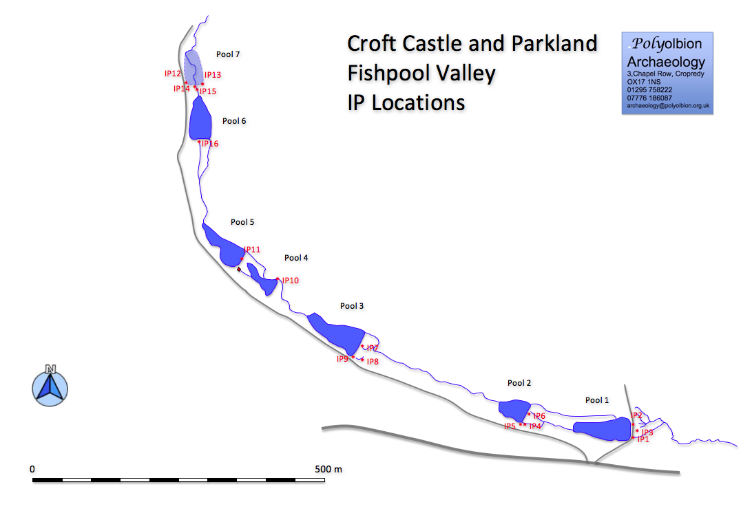
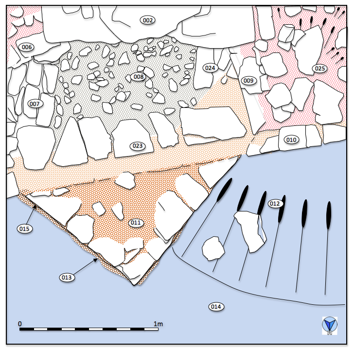
But first an outline location map to keep track of where things are.
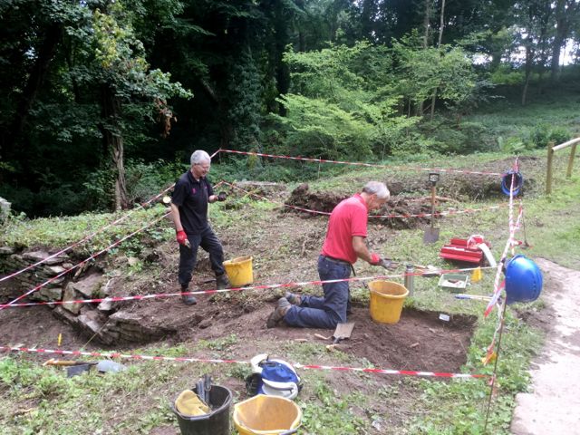
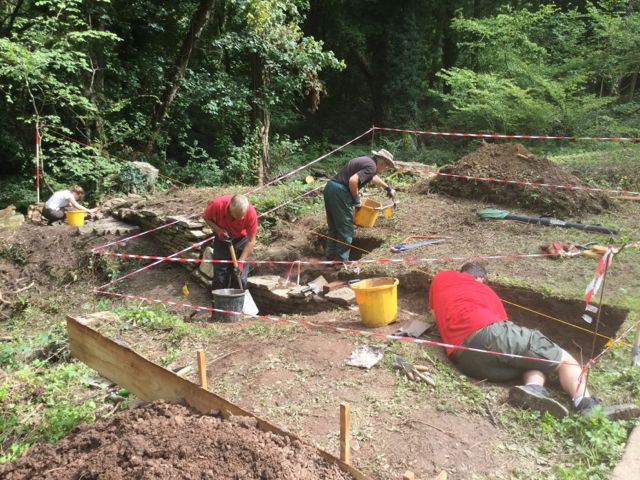
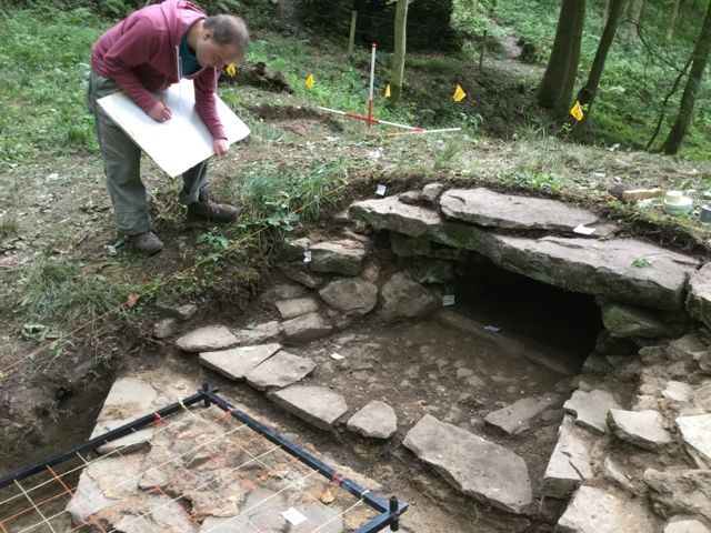
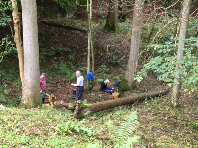
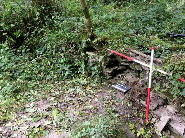
Monday August 14th.
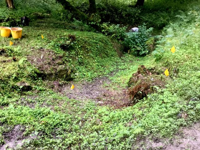
We met with Imogen, the project manager for the Trust at 1.00 pm and toured the site discussing in detail the siting and scale of each intervention point ( hereafter IP ), marking them out and in the process littering the valley with a series of little yellow plastic flags.
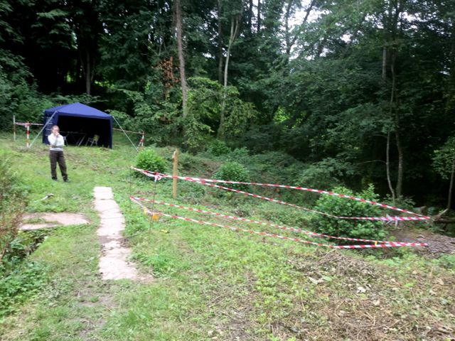
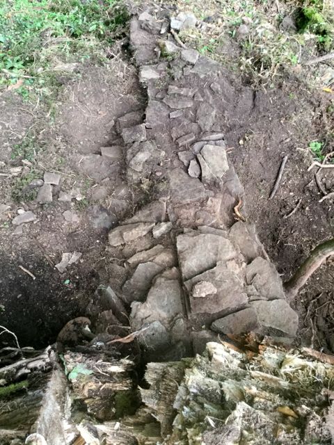
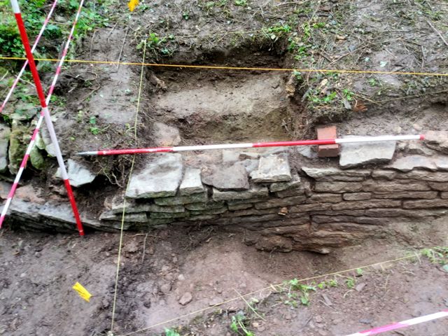
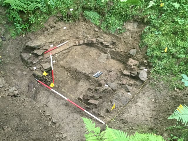
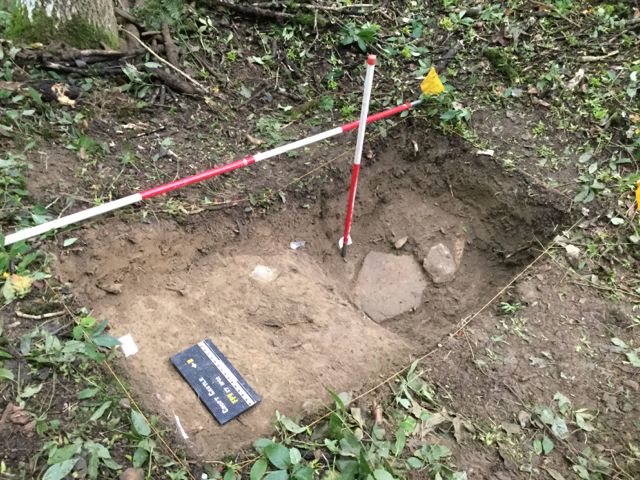
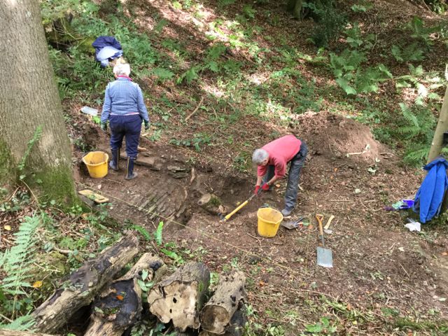
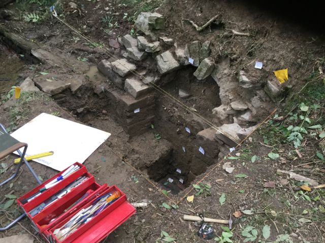
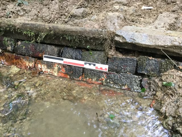
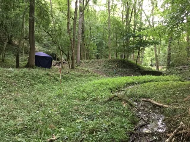
Back at Pool 1 we then established a base camp with gazebo, tables, chairs and what have you to keep the rain away. Once set up it was time to mark out out the trench for IP2, initially 4 x 2 m although it is not intended that all this be dug but rather that work on the wall Iines up with investigating the upper surface of the dam. However, before undertaking any digging the remainder of the day until 5.00 p.m. was taken up with carefully removing the undergrowth from the existing exposure of wall, what we call 'archaeological weeding' it being important to cut roots rather than pull them less the wall comes tumbling down. Fortunately at an early stage it became clear that the wall was mortared rather than dry built with extensive traces of a hard pinkish red gritty mortar surviving. A study of the mortars is likely to be important when it comes to getting any sort of idea about building sequences in the valley
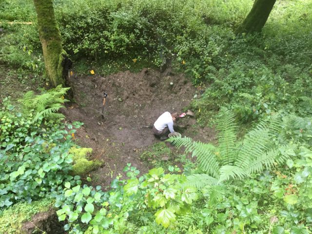
As we began digging within the marked out area it became clear that the topsoil with its flora of brambles, ivy and ground elder would not lift as turf for stacking so a spoil heap was started 2 m S of the trench. Part of the brief was to ensure that any spoil did not pollute the watercourses and so began a campaign of revetting our heaps with boarding. By the end of the day at 5.00 pm we had cleared approximately 4 m of wall. Early indications suggest more than one phase of construction and some purposeful changes in alignment.
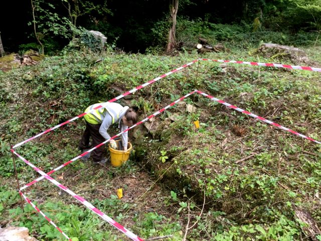
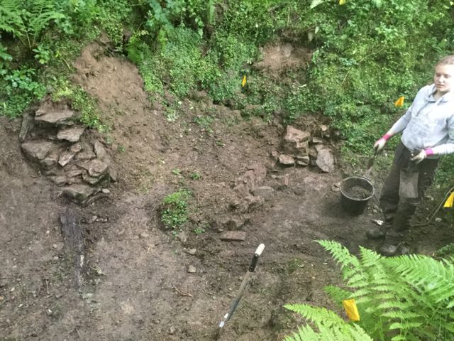
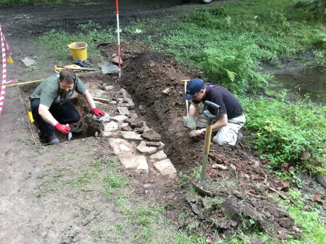
Sarah contemplating the area marked out for digging and getting started on some archaeological weeding on what turned out to be the south wall of a spillway.
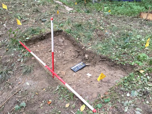
Tuesday August 15th.
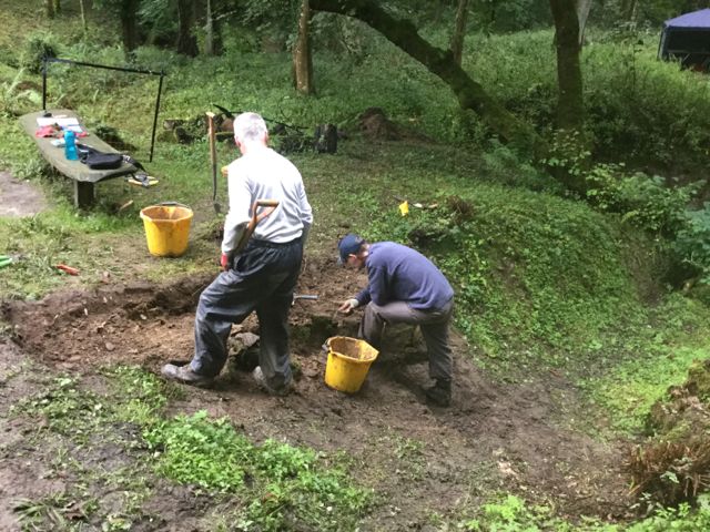
After a trip up to the cafe for clean water we started by extending IP 2 by 1 m to the south in order to pick up the width of the wall 001 and the nature of any associated deposits to the south. Turf stripping 002 at the west end of the trench enabled us to build a low turf retaining wall around the spoil heap. After a meeting with Jason to discuss the work two volunteers were introduced and given a site induction. They completed the turf stripping whilst Sarah carried on tracing the line of the wall further east.
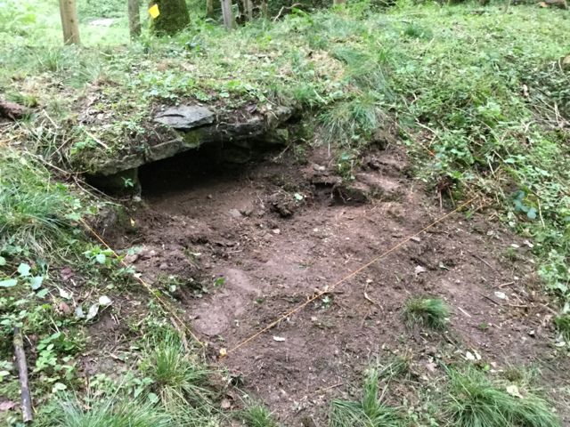
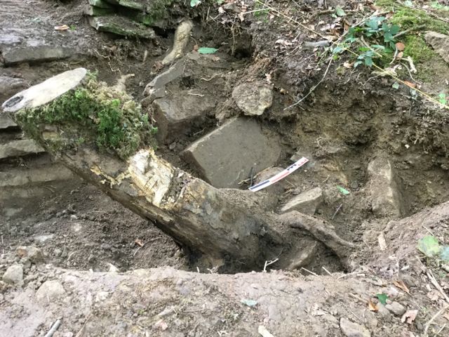
I completed some clearance of vegetation and fallen branches at IP1 and examined the make up of the dam and the stone walling that acted as a seating for a modern concrete pipe. This walling whilst probably recent is similar to the wall at the north end of the dam to pool 2. There were no signs of any other early structures. The dam itself seems almost entirely composed of a weak silty clay which has been readily scoured away. Conditions at IP 1 are actually quite dangerous and apart from some photography and sample taking no further interventions were planned.
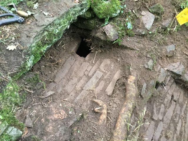
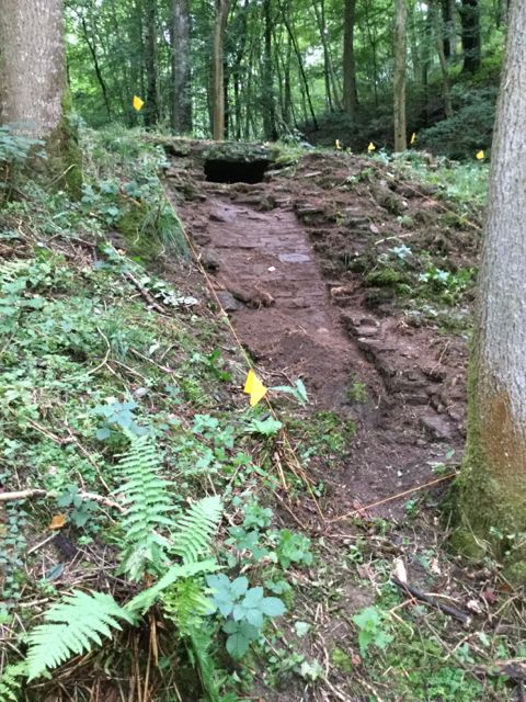
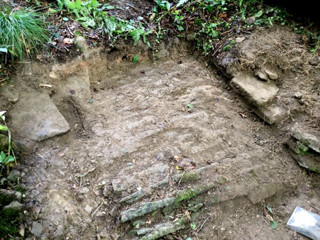
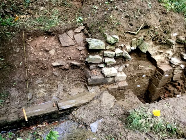
At IP 2 a partially metalled surface 003 was cleaned and shown to be in the form of a low bank rapidly dropping away to the east. Further work to pick up the return of the wall 001 where it met the east wall above the tunnel lead to the discovery of a complex structure involving a wall that extended much further to the east than expected and a possible paved area.
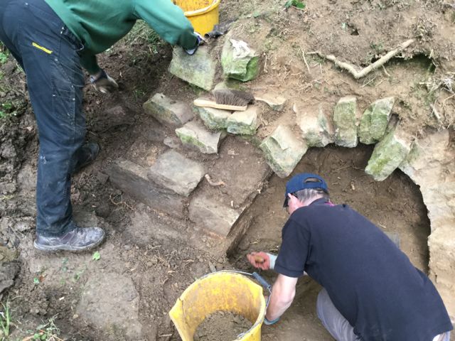
In the afternoon the volunteers Ian and Malcolm cleared fallen trees and undergrowth from part of the east face of the dam and then removed weeds and moss to uncover the continuation of the wall to the east. Further flat slabs were mortared in place against its north face suggesting possible small steps indicative of a cascade however the relationship with the north-south tunnel wall remains problematic. Additional work to clear along the face of wall 001 revealed a remarkable survival of an area of pitched stone paving which has initially been interpreted as the base of a spill way running down from the pool.
Two of the Trust's volunteers get started on the excavation of the upper part of the spillway whist the weeding continues.
Below the north south cross wall the spillway wall continues alongside some shallow mortared steps, could this have been a cascade? Then we have the possibility of a buried wall continuing even further down the face of the dam...
... confirmed after some superb work by Ian and Malcolm.
Meanwhile cleaning in the tangled ravine at the south end of dam 1 has uncovered another retaining wall and helped us take a look at the make up of the dam itself, not a place you would want to hang around.
Wednesday August 17th.
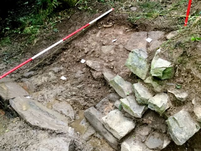
First up was the completion of the recording of features at IP 1 as well photographs four separate contexts were noted. At IP 2 a red gravel bank 010 was removed to a depth of 0.4m to reveal the continuation of the side wall of the spillway as it approaches the water's edge. No traces of the pitched stone base were seen but a buff clay bedding for the stones was noted here and towards the eastern end of the spillway.
The Trust volunteers began by carefully removing roots that had grown over the pitched stone surface and then removed further roots that were obscuring the junction between wall 001 and the north-south wall 006. Work was then completed to clarify the exact line of wall 001 which resulted in the discovery of possible whetstone fragment in the topsoil. Additional clearance established that the wall 006 was not contiguous with that flanking the tunnel IP 3 but rather its courses finished until it faded into the bank at its southern end.The area representing the upper tier of the cascade was further examined and its width extended as tumbled rubble was removed. This lead to the discovery of the base of small glass vessel again in the topsoil.
A lengthy site meeting / discussion was held with Jonathan, the person responsible for designing the new scheme for managing water throughout the valley, about the engineering aspects of the project and later similarly with Imogen.
Expert work to remove in-growing roots from the small surviving portion of pitched stone paving plus some finds, pity they were in the topsoil.
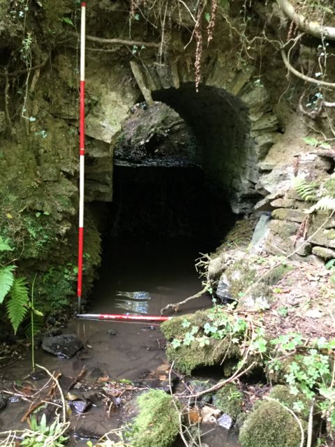
After a very wet night and. morning the attempt to dig at ab the mouth of the partially collapsed tunnel, IP 3 was abandoned as the ground was running with water.
The upper part of IP 2 was sponged dry and work continued to remove the red gravel bank 011 that capped the dam and filled the former spill way. At the close of the day yesterday the beginnings of a yellow clay deposit was noted about 20 cm below the top of the wall 001. In practice the clay dropped away rapidly leaving the team with up to 60 cm of gravel to dig. A similar spread of red gravel was seen to the south of wall 001 and this was removed onto another yellowish clay bank all of which post dates the wall, the buried portions of which remain well preserved. It was also shown that the side wall to the spill way was secondary to the north south wall. The rear of wall 001 was examined to establish that it was a single faced revetment wall and by the end of the day the whole complex had been recorded in plan by photographing sections of wall beneath a measured in and leveled up planning frame.
Up at the second dam two trenches were marked out ( IPs 5 and 6) and the turf removed to examine the crest of the dam for evidence of spillways. In addition some clearance at the foot of the retaining wall at the south end of the dam was undertaken (IP7), however the increased water flow lead to second thoughts about the extent to which one could remove silting from a possible culvert without precipitating the sudden drainage of the pool!
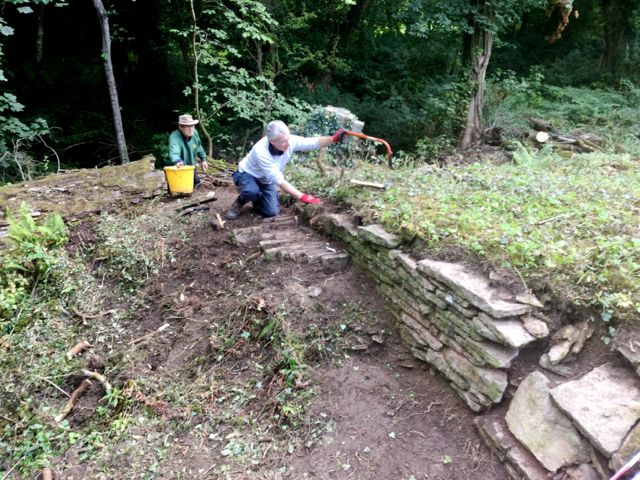
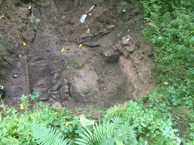
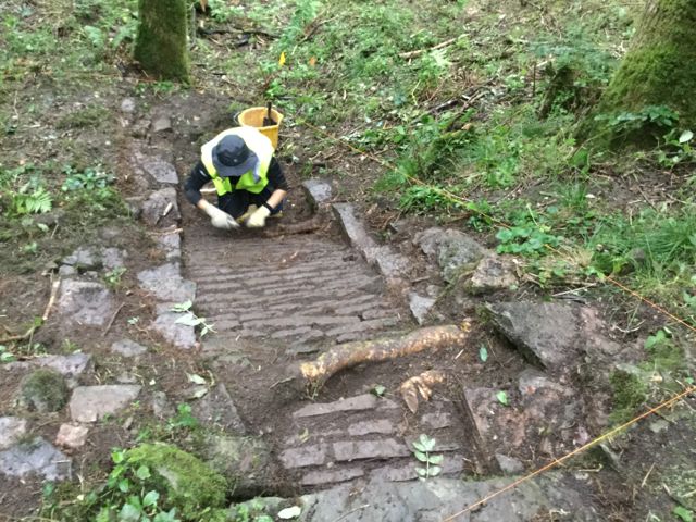
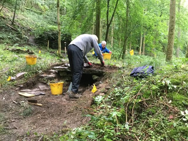
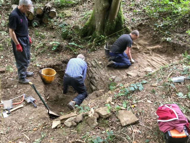
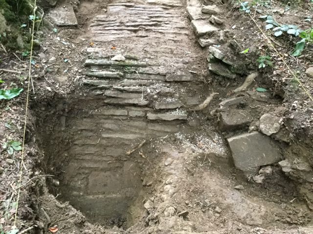
Now we're really getting on with it, four volunteers to dissect the south wall of the spill way and here are the fruits of their labours: the wall excavated down to its lowest course.
Friday August 19th.
A measured photographic survey was carried out at IP 2 so that both plans and elevations could be generated digitally.
At pool 2 work begun yesterday at IPs 5 and 6 to remove the turf and topsoil was completed. It was concluded that no structural features were present at the centrally located IP 6 and that the channel that appeared further to the east was probably a consequence of a leak in the dam. Back at IP 5 a trench 2.5 x 1 m was opened at the top of the retaining wall to examine the possibility that a cascade had been located here. No such traces were found so it was concluded that the water was originally drained through a conduit that opened at the bottom of the wall which is also being cautiously investigated
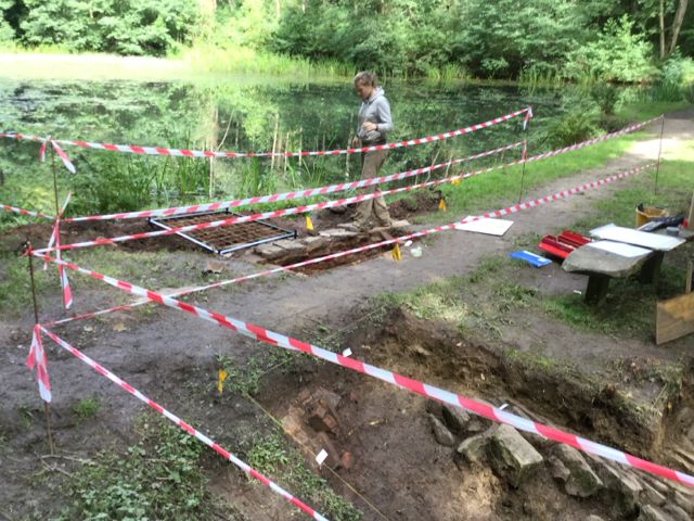
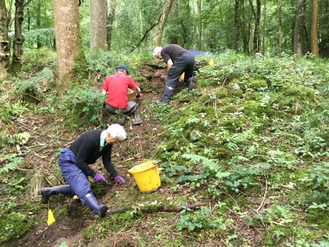
Meanwhile two volunteers had begun work at pool 3 to clear vegetation and fallen branches so that two new trenches could be opened up on Monday.
Heading up the valley to pool and dam 2 an area is cleared at the top of the retaining wall but no evidence for channel or cascade.
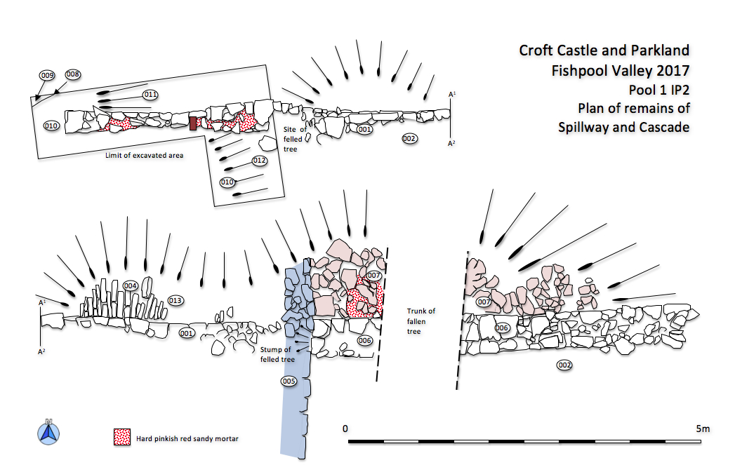
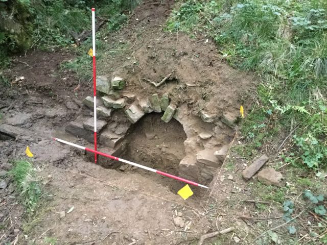
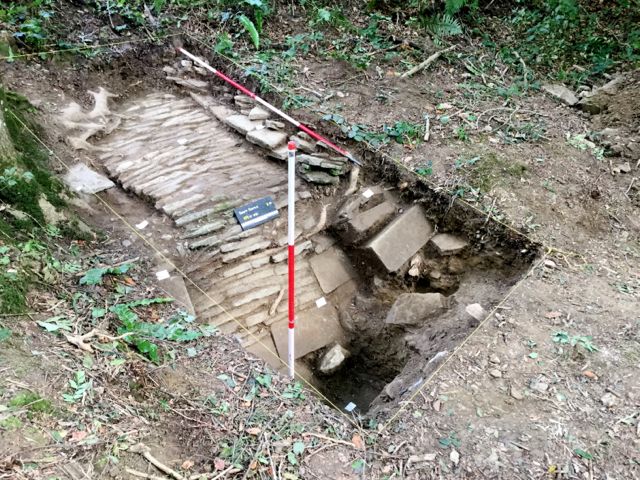
The plan of the line of the spill way and cascade drawn from digitally enhanced and perspectively corrected photos.
Monday August 21st.
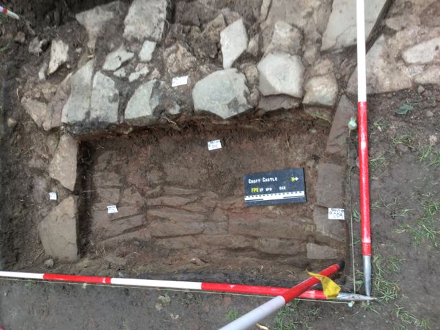
After relocating ' base camp' from pool 1 to pool 3 work began around 1.00 p.m. Exposed walling near the crest of the dam (IP 9 ) was cleared and once the extent was obvious a trench 4 x 1 m was marked out. Cutting back across the top of this wall revealed it to be the southern edge of a setting of pitched stones. At present it's not possible to say if this is the top of a tunnel or the base of a spillway!
Down in the lower area where the channel appears to make right angle bend (IP 8) a series of walls and collapsed brickwork were examined. They make little sense at present but obviously are the remains of a significant structure. Work was also started on a small trench ( 1.5 x 1 m ) to the north of the area to look for traces of a conduit or pipe at this point. After excavation to depth of around 0.5 m the ground is looking fairly undisturbed.
A site tour of the areas currently open was made with Imogen and Janine, the area archaeological adviser for the Trust.
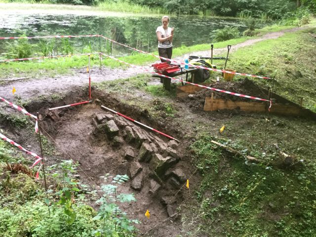
And so we arrive at pool and dam 3, the Trust's volunteers have already cleared the ground of undergrowth and other debris.
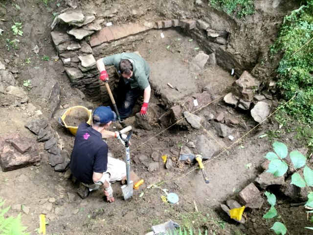
Up near the dam work Ian and David begin on what was rather disrespectfully named the rockery whilst down in 'the pit' the stubs of two walls are exposed by Sarah.
Tuesday August 22nd.
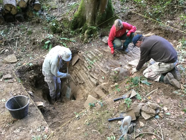
Work advanced on two fronts. Up on the pitched stone surface ( IP 9) further excavation by our volunteers defined the limits of the feature and established that it was unlikely to be the top side of an arched culvert so we returned to examining the idea that we might be looking at a spill way. An area 4 x 1.75 m has been strung out but an extension at one end of the trench to the north will be marked out tomorrow to determine the full width.
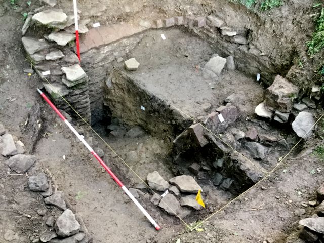
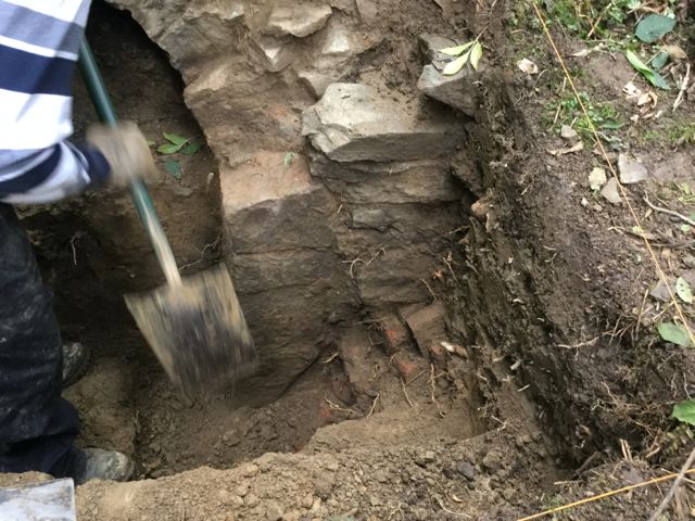
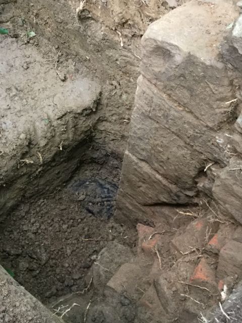
Down in the lower area (IP8) a major effort was put in to clearing the corner adjacent to the already identified stub of wall. This revealed the remains of a built structure comprising of stone walls surmounted by traces of a shallow barrel vaulted brick ceiling. The eastern and southern sides were intact with a potential entrance to the north. The western side was in a state of considerable collapse. The interior was dug to a depth of around 30 cm and an area within the north east corner dug to a further 30 cm. The function of this structure remains uncertain at present.
A short distance to the south a small trench 1 x 1 m was dug to investigate the possible continuation of a channel or pipe. The area was dug out to a depth of around 60 cm and appeared to be natural.
In the afternoon some additional recording was carried out down at pool 2 prior to back-filling. In addition the base of the retaining wall at IP 4 was examined and it was shown that there appeared to be a flat topped but slightly recessed opening from a drain running below the wall.
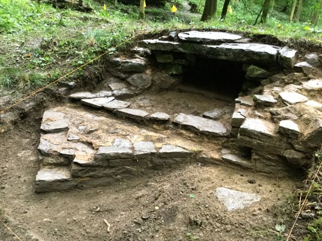
Great discoveries: the pit turns out to have been vaulted over in brick and the rockery turns into a pitched stone spillway.
Back at dam 2 more delving reveals a set back course then the beginnings of the culvert that enabled water to be drained from the pool.
Wednesday August 23rd.
Progress in four areas today although conditions were quite wet and slippy for much of the time. At IP 8 the north east corner of the sunken building was identified as an area for further exploration and accumulated deposits were removed from here to a depth of nearly 1 m. The lower levels became increasingly dark and loamy suggesting that the floor level was not too far below. Worked was stopped at 1m for safety reasons at which point large quantities of brick were noted indicating the collapse of the brick vault. The function of this structure remains problematic.
The volunteers working 'up stream ' dug an additional metre square to the north of the original trench. This showed that the pitched stone setting was without doubt a spill way of some kind but more significantly revealed a central gully which presumably would have managed a limited flow of water to give a rill like effect. This feature terminated with a line of cross stones creating a. small cascade. The exact limits of this spill way have yet to be determined but a third trench was opened up with aid of additional volunteer labour which appeared towards the end of the afternoon.
In order to examine the lip of the dam an area 2 x 1 m was opened up and an edging wall to the pool uncovered. Behind this was a further pitched stone channel bounded to the south by a low stone wall. However this latest channel has the base stones running in a different orientation and alignment to the spillway just a metre or so to the east!
Finally a small trench was opened at the mid-point on the dam to examine the possibility of a pipe or conduit emerging here. Large quantities of broken glass and pottery of mid-twentieth century date were encountered here but no evidence of any structures yet.
Now the outlines of our 'sunken building' are becoming clear and Sarah works heroically to bottom out the side wall in the north east corner.
The extension to the spillway trench uncovers a rather picturesque little gully along the centre line of the feature.
Everyone is getting really keen now as Jason and David examine the pool side wall and uncover a second spillway... sort of.
Thursday August 24th.
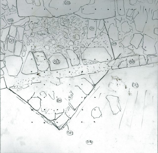
Much of the day was spent recording. A leveled base line was set up to link together the three main areas under excavation and detailed plans started using a planning frame. Further context numbers were allocated on context recording completed for IP 9.
The volunteers widened the trench at the edge of the pool to pick up the other flanking wall giving the overall width of the channel. They also helped remove some of the rubble defining the western side of the sunken building and located its north west corner. This gave us the width of the opening to the north which we had assumed was the original entry but also puzzlingly indicated there was a similar opening in the west side of the structure.
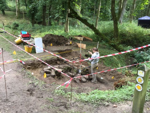
A massive campaign of recording is underway as Sarah plans part of the spillway and the upper portion is photographed.
And still the 'sunken building' defies our best efforts to bottom it out.
Friday August 25th.
After a preliminary visit to take another look at the pump house up stream work was completed on planning the exposed features and a measured profile/section was drawn through the three open areas to link them together. There remains some work to be done on the written descriptions of individual contexts.
The volunteers began by further digging an area to the east of the centre of the dam. Further evidence of twentieth century dumping was recovered but nothing structural was observed. Work shifted to IP8 where another 30 cm of fill was removed from the north west corner of the sunken building to further expose the 'column' .
Amongst the many visitors we spoke to a retired waterways engineer who suggested that the differing orientations of pitched stones within the spillway could be related to one set being closer to the lip of the dam and therefore subject to different pressures, however this doesn't realign explain the different alignments.
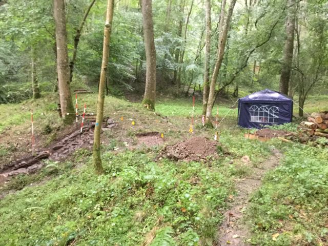
At the end of the morning additional barrier tape was put in place and 'base camp' was taken down and removed to the estate yard for storage until work begins again on Monday September 4 th.
The 'sunken building' cleaned up for photos whilst Sarah continues with the planning.
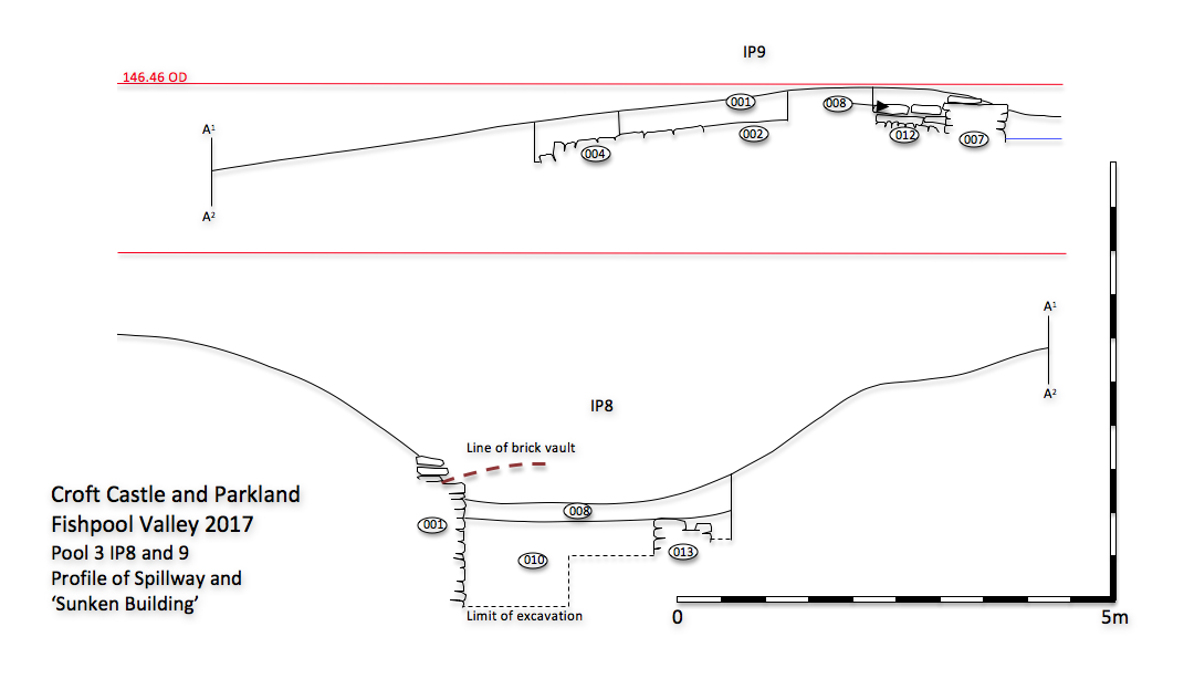
... and here's the drawing linking the three main sites at dam 3.
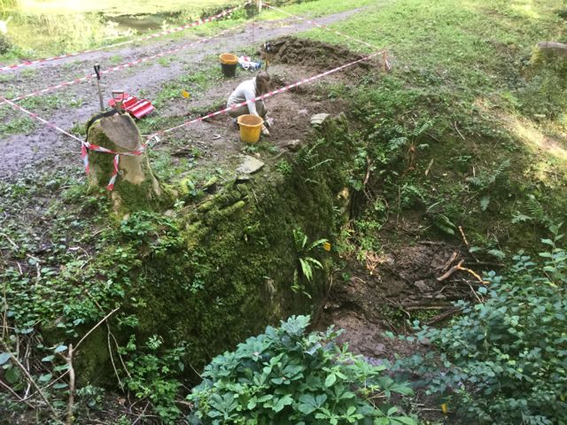
Monday September 4th.
Work begins with John, David and Anita on the hunt, there's a cascade here somewhere.
The top of the cascade with an eroded void showing where a couple of stones had dropped. The up stream side of the culvert with signs of a flanking wall starting to appear.
Setting up after lunch with gazebo, table and chairs to establish base camp at pool/dam 7 , marked out three of the four 'intervention points ' and started on working to clear the down stream face of the cascade IP14. Remarkable effort by our increasingly skillful group of volunteers who during the course of the afternoon revealed most of the pitched stone face of the cascade. Interestingly much of the pointing to this surface has failed allowing the water to erode away the underlying fabric of the dam, however such was the form of the construction that the body of the cascade has held together in a way which makes full restoration a very real possibility.
Mid-afternoon two more volunteers arrived so we opened up an additional trench to explore the arrangements for the over spill from the pool into the tunnel above the cascade . Two possible phases of construction here although still much to do. The turf and topsoil was also removed from the trench IP13 marked out to examine the possibility of an additional spill way at the east end of the dam.
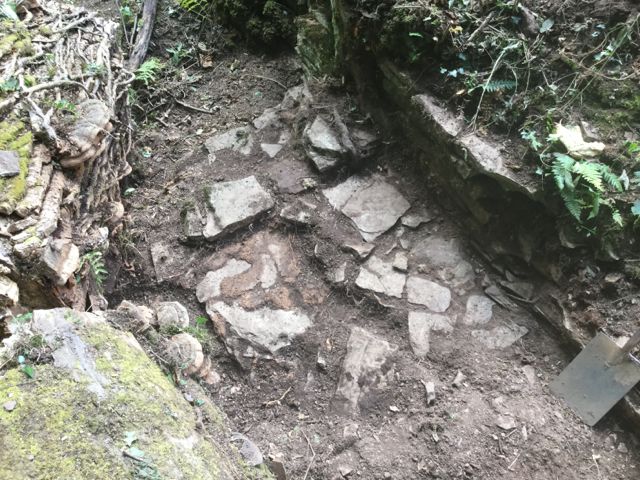
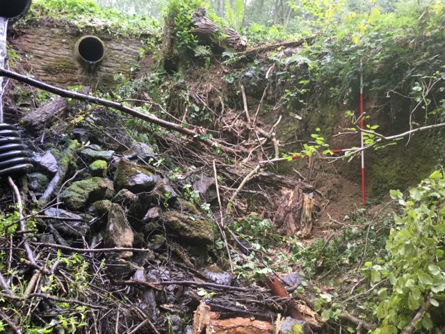
During the previous week I had examined the historic mapping for the valley and noted from the late 18 th. century estate map a feature labeled as 'conduit ' off to the north west. Although heavily overgrown there are traces of a built structure visible which may be worth further examination.
By the end of the day the full extent and level of survival of the cascade is becoming clearer.
Tuesday September 5th.
After a poor weather forecast for the day it all proved to be surprisingly productive. After an early start I spent some time clearing a path to the site of the potential conduit house. Back at dam 7 I completed marking out the full extent of the four areas currently under excavation before the volunteers started arriving. On the main cascade the lower section was cleared to uncover the end of the steeper section and the start of a paved level section. The situation here was complicated by the presence of two exceptionally large stone blocks which may be tumbled capstones from the tunnel through the crest of the dam.
We approach the point at which the cascade bottoms out Viviana starts to uncover two huge blocks. The cleaned cascade at the end of the second day.
More work was done to clear this tunnel of accumulated debris with the aid of a long handled rake. The eastern part of the flanking wall to the cascade was examined in detail with particular attention being paid to its relationship to wing wall running along the face of the dam.
On the pool side approach to the tunnel the wing walls to the east and west were cleared as was an additional wall which appeared to cross the mouth of the channel. This projected out to the north to create an unusual triangular platform which presumably acted the way a cut water does on a bridge to diminish the flow of water. It is a very curious feature and this may not turn out to be the real explanation .
All in a day's work, the excavation of IP14A from start to end, almost.
Finally the small trench across the shallow cut at the east end of the dam shows no trace of any built structures such as a spill way, however, the upper portion of the dam at this point seems to contain a lot of debris, including slag and burnt stone which appears almost industrial in nature, alternatively it could be material derived from the partial demolition or clearance of the grotto to the south east.
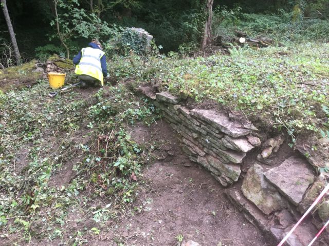
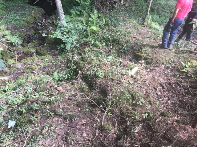
Before work started I had made another expedition up the narrow valley to the north west to photograph and examine in more detail some of the building debris that may mark the site of an 18th. century conduit house.
The small valley divides at this point to the right and left with serious quantities of stone rubble, brick and tile and their meeting point.
Wednesday September 6th.
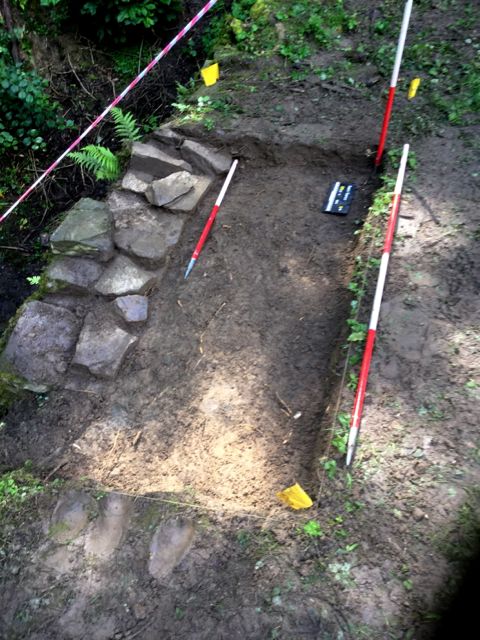
A 2 x 1m trench was opened at IP12, the possible bypass channel at the western end of dam 7. This uncovered the profile of a 'V' shaped ditch but there was no evidence of any associated structures. The trench was recorded photographically and is ready for back filling as is the trench at IP13 which has been similarly recorded.
Two side shows: the ditch IP12 to the west of the dam and the ditch IP13 to the east, neither of them terribly exciting.
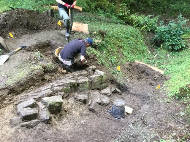
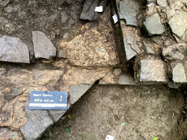
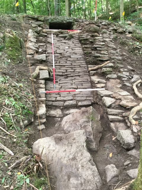
The curious triangular feature in front of the inlet to cascade was excavated down to a construction level above a platform of hard yellow clay and recording started. On the cascade more work was done to clarify the line of the flanking walls and the rockery like spread of stones on the face of the dam to the east. One of the difficulties in being so busy is the lack of time to take in the bigger picture. At lunch time I took a look in the grotto that lies a short distance to the south east and noted that the small 'window ' opening in the south chamber of the grotto frames the view of the cascade perfectly.
Ian engages some potential volunteers in conversation. The spread of mortar at the foot of the stonework indicates a period of construction.
The cascade perfectly framed when viewed from the grotto, looking north west.
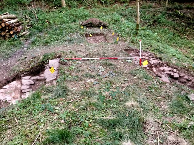
IP15 after some archaeological weeding and a little digging looks very interesting. A view of the crest of the dam with our three current trenches looking east.
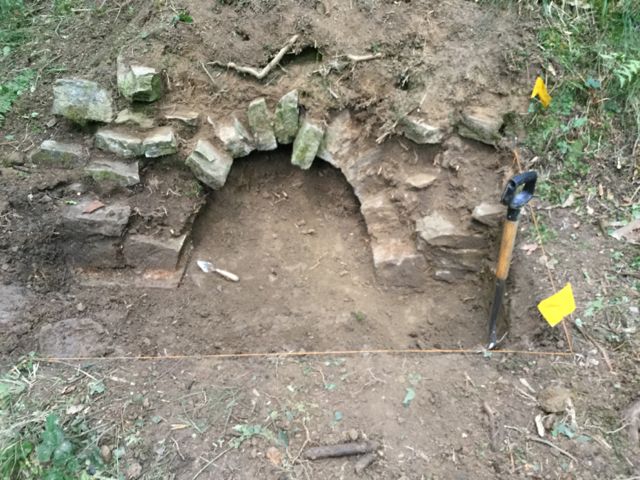
The final area on dam 7 was opened up, IP15, and initial results show that the arch above the culvert is parabolic in form. Other possible walls in the vicinity were examined and shown to be random spreads of rubble.
Thursday September 7th.
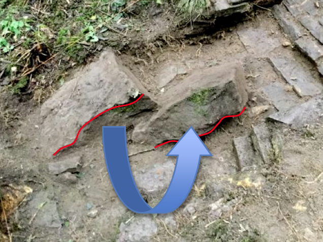
Two halves reunited, the fallen capstone.
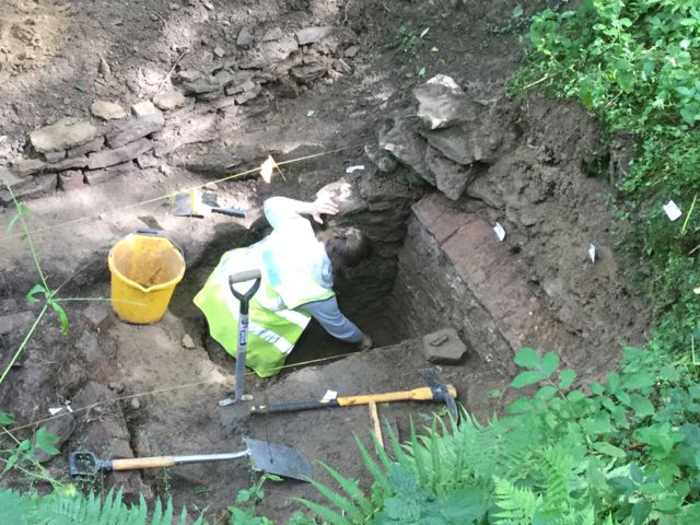
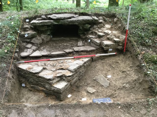
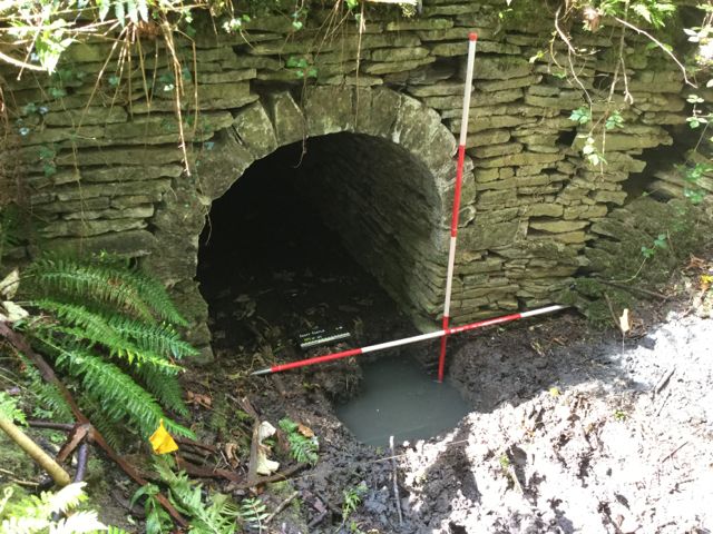
At the start of the day I spent some time examining the huge stones that Viviana had uncovered on Tuesday and it became clear that they were two halves of one much larger piece presumably broken as it tumbled down from the top of the cascade. Otherwise much of the day was spent recording in plan and elevation details of the rest of the cascade. A new volunteer, Dan, who has just graduated in Archaeology was able to assist with this. It is becoming clear that the structure has a complex history. Meanwhile the rest of the team were busy at IP15 examining the outlet from the culvert at the west end of the dam. This is turning into a major feature and is undoubtably one of the best built structures in the valley and clearly set up to be seen. Work was focused on determining the full height of the opening and the nature of its flaking walls. This is our best opportunity to understand the nature of these conduits in a stratified context. The level at the top of the underside of the arch was measured and compared with the level of the base of the dry pool to the north. This indicated that the entrance to the culvert could still be half a metre or so below the current ground surface.
Dan puts his back and sanity at risk by drawing loads of small rubble fragments whilst John and David have a great time delving down after the base and sides of the conduit through a thick build up of silt and clay.
The fruit of their labours, IP 15 still going down.
Friday September 8th.
A very wet Friday morning with everything dripping and slippy, fortunately by around 10.00 it had brightened up considerably.
After a damp start the decision was taken that digging today on IP15 would be a little unsafe: a deep hole in slippery conditions and so the volunteers moved back down the valley to Dam 6 to examine the full extent of a pitched stone surface which was just visible at the foot of the dam (IP11). With Imogen's approval Ian and Anita carried on into the afternoon and were rewarded by the sight of what is evidently the remains of another cascade taking the plunge into a near vertical face, yet another new take on displaying the flow of water in an interesting way.
Dan, Ian and Anita start to get to grips with the area below dam 6 and soon have a new pitched some channel with flanking walls to display.
... and by later on that afternoon things are taking a very strange turn (Thanks to Ian for this photo )
Back on dam 7 time was split between planning and context recording. In connection with the latter some targeted small scale dismantling of limited sections of the walling was undertaken to establish a constructional sequence. After further deliberation the current thinking about the triangular projection is that it may be a seating for a metal grid to hold back fallen branches o and the like to prevent the culvert getting clogged up and the cascade becoming untidy. It bears some resemblance to the feature recorded at the south end of the dam at Packwood in 2015.
Detail of the complex sequence of events relating to the repair and new build on the north end of the conduit.
Here is the field drawing of the north end of the culvert...
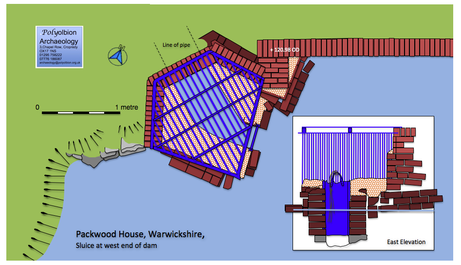
... and here is the drawn up version of the sluice at Packwood which has its similarities.
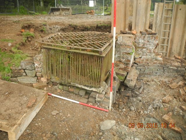
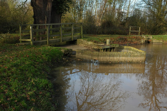
... plus a photo from Packwood and on a larger scale the weir at Croome.
... and finally here's the plan of IP14 drawn up and at roughly the same scale
Monday September 11th
After the usual lunchtime start we were able to make good progress with David and Bob working of uncovering the base of the arched culvert at IP15 whilst Ian and Anita returned to their task at the foot of dam 6, IP 11, I was able to continue with the tricky task of planning the cascade at IP 15, difficult of course because of the slope.
The area IP 11 revealed at the end of the day on Friday that the pitched stone surface of the presumed cascade took a sudden turn downwards from which point it dropped steeply for around half a metre. Unfortunately further clearance of this lower level was prevented by the presence of a tree stump which Ian made valiant efforts to dig out. Up on the main body of the cascade Anita chased the pitched stone surface up the face of the dam. The gradient continued to rise gently suggesting that there is a further steep if not vertical component to come, unless of course there was an outflow from a culvert that supplied the water.
Ian sets to with a will whilst Anita contemplates the stone work.
I had an interesting conversation with the engineer who runs and maintains the pump just up the valley. He claimed to have been working this pump for 30 years now and reports on the progressively diminishing supply of water to the valley, some years ago they were regularly able to run the pump for 12 hours, this has not been possible for some time. Given that the valley is based on limestone is it possible that a previous copious flow could have vanished underground at some point, perhaps as the outcome of an earth tremor on the Ludlow fault?
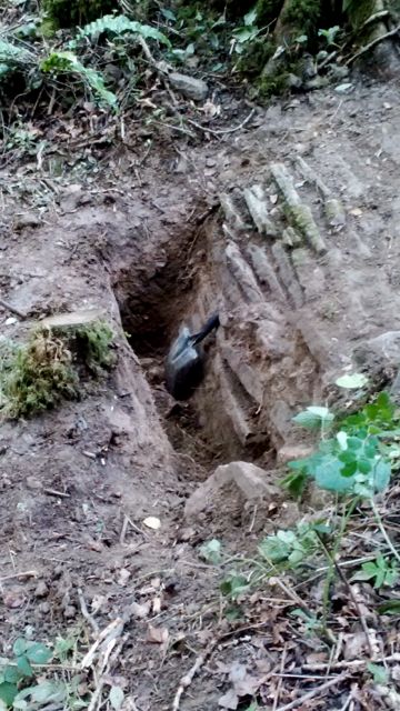
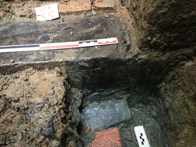
The arched culvert at IP 15 was finally bottomed at a depth of around 150 cm and the jambs shown to be constructed of well dressed stone throughout. The base of the culvert appears to be timber lined which is particularly interesting as is the dense spread of brick which appears to have been dumped in to narrow the exit channel without actually closing it.
Bob - I think - spading out the silt to uncover, eventually... timber.
Tuesday September 12th.
Most of my time today was devoted to excavation the final half metre or so underneath the archway at IP 15 . This proved very rewarding as the work revealed a brick bottom to the culvert edged with a well preserved timber sill beam. There is an additional piece of timber lying across this which looks a little like a stave from a wooden bucket, however it was decided to record these features in situ and not attempt to lift them. All this lies at nearly a metre and a half below current ground level and this together with a far superior mode of construction suggests a different, earlier phase of activity within this part of the park. I don't find the suggestion that it is some sort of a housing for a hydraulic ram very plausible, my feeling is that it is the outlet to a scour tunnel but one designed to make positive visual impact on the landscape. Further investigations are made difficult by the depth we are working at and the proximity of the stream. We will concentrate on cleaning up what can be seen of the small weir to the west but not undertake any more digging here at this stage.

The slightly dizzying view down into the hole at IP15 showing the brick and timber base.
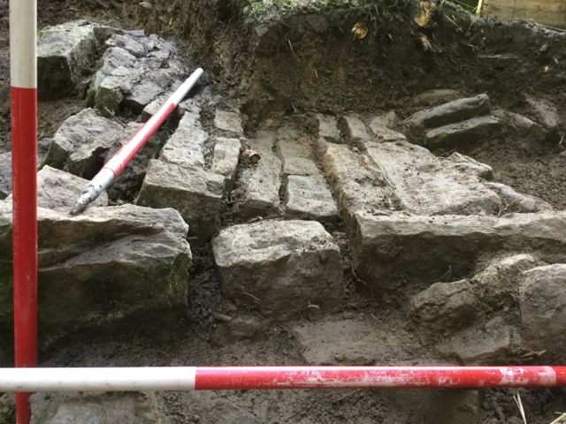
Another three square metres of the cascade at IP14 were drawn, just two more to complete in the morning.
Down at dam 6 three of our volunteers: Ian, Malcolm and Dan continued to clear the pitched stone spill way and follow the steeply sloping section to the south. This necessitated some serious effort to remove the stump of a felled tree before the face could be accessed. It is possible that bottom has been reached. Significantly the lower courses seem to composed of much larger well squared and dressed blocks, do these represent a later repair or are they part of the original construction designed perhaps to resist turbulence at the foot of the cascade. Hopefully we will finish this area off tomorrow.
A bar to progress, the unfortunately placed tree stump.
Then, as if by magic, it's gone, how do they do that? More of the face of the cascade is uncovered showing the use of larger dressed stone blocks.
Wednesday September 13th.
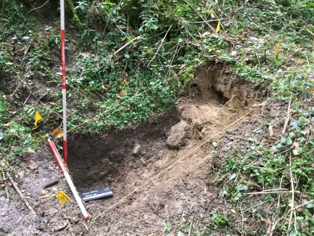
Work began on the last IP to be opened IP 10 below dam 5. Again there seemed be the appearance of a channel emerging from the foot of the dam but when this was half sectioned there was no evidence of any structures. This situation echoes the difficulties we had on dam 2 and 3 and it may be reflecting on the situation further up the valley in that we are simply missing features because they are so deeply buried. In the afternoon the team were reassigned to continue work on the curiously formed cascade below dam 6. Up on dam 7 the drawing of the cascade at IP 14 was finished as was the elevation of the arched opening at IP 15, thanks to Janine for helping with the levels and preparing the main cascade for photography.
The trench dug at the foot of dam 5. The impedimenta of drawing on IP15
The newly cleaned cascade at dam 7, photographed from this angle the tumbled and broken capstone tends to dominate the view.
Thursday September 14th.
The last full day for digging so an early start back where it all started at dam 1 with IP1. The intention had always been to return to examine the base of the tunnel after a spell of dry weather which never materialized. An area close to north side of the opening was dug through a variety of silts to a depth of around 40 cm at which point stone slabs were encountered. Unfortunately the water was flowing in faster than it could be bailed out so without further measures to drain it IP1 will not be progressed any further.
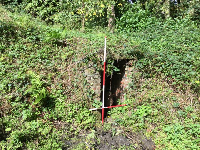
The end result of half an hour shoveling mud, a hole full of dirty water at IP1 and whilst I was down that way I tool a look at the housing for the hydraulic ram there.
Up at dam 3 an hour or so was spent with the day's three volunteers searching for traces of a spill way, conduit or cascade as per Jonathan's request . A number of small test pits were dug following extensive probing using road pins but nothing but modern debris was seen.
Dam 4 saw the same team later in the morning clearing the undergrowth from the weirs at the east end of the dam in order to annotate the drawings from the 2007 survey. Some significant variations were noted. Clearance and photography was also undertaken on the curious spillway at the east end of dam 5. Moving on to the channel below dam 5 the bottom of the trench was lowered by another half a metre without any structural elements being identified.
IP 10 on dam 4 a combination of stone and concrete block walling but no trace visible of an earlier sluice of spillway underneath the concrete sandbags.
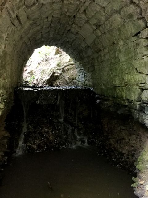
However the adjacent tunnel was interesting, particularly the way in which erosion had dropped the interior by nearly a metre severely weakening the walling above.
Although not on the 'to do' list I also took a quick look at the sluice / spillway at dam 5, further serious decay of the stone work since the 2006 survey.
Up at dam 6 further work confirmed
that the base of the channel below the cascade had been
identified. Finally at dam 7 the excavation of the arched opening
to the culvert was completed by taking out a section in front of
the sill beam showing it to be square in section. Could
dendrochronology be an option here? Traces of a lower level brick
paved surface were also revealed. An area was opened up to the
west to examine the deposits north of the small weir. This may
indicate the presence of another sloped spill way. A plan and
elevation was completed for this area.
The team sense time is running out at IP 16 and redouble their efforts, well that's what they told me.
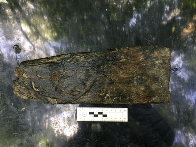
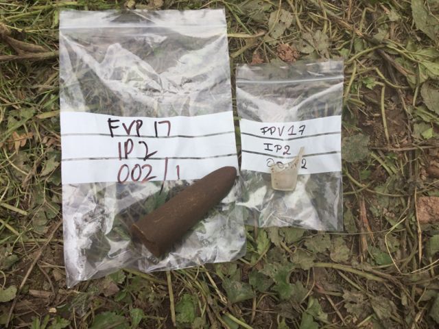
In order the determine the thickness of the sill beam it was necessary to remove the loose piece of timber (now known as FPV17 IP15 010/1) which appears to have interesting markings on it, and a further 30cm down, more brick.
The excavation of the site of a possible weir to the west of our arched opening.
Friday September 15th.
A busy final morning initially completing the planning at the arched opening at IP 15 and filling in the context sheets. There are traces of a plaster like substance on the left hand side of the archway which leads, together with the high quality stonework, one to wonder if this structure could have been more of a niche perhaps with water issuing from a sculptural feature. I also took the opportunity to take some further photographs of the area around pond 7 and reflect both on the in-coming water supplies and the possibility of an earlier medieval pool 'fossilized in the base of the later structure.
A sloping bed of mortar with some surviving slabs above the brick faced mini-cascade. This part of the structure has tipped backwards, possible following the removal of a supporting wall.
After cleaning back a little more of the soffit of the arch what do we see, plasterwork or just lime scale?
The 'natural' cascade entering pond 7 from the north west.
A view of the site of pond 7 looking south the lower terrace below the gazebo shows up as belonging to a possibly earlier pool and the two tier nature of the dam is also evident.
Down at dam 6 the trench, IP 16, was tidied up by the volunteers who were able to clarify the layout of the pitched stone surface and its flanking walls as well as revealing further details of the steeply sloping face of the cascade. The morning finished with the recording and photographing of the site.
The cascade at IP16, dam 6 looking north east, do the very fine stone blocks, plus the great depth of silting tie this is with the well cut stone work at IP15?
At the end of it all it is satisfying to record that all 16 intervention points were examined in the course of 16 working days on site, an achievement only possible because of the valuable contributions of the local volunteers. Needless to say there are numerous loose ends to tie up, we'll see what the future holds....
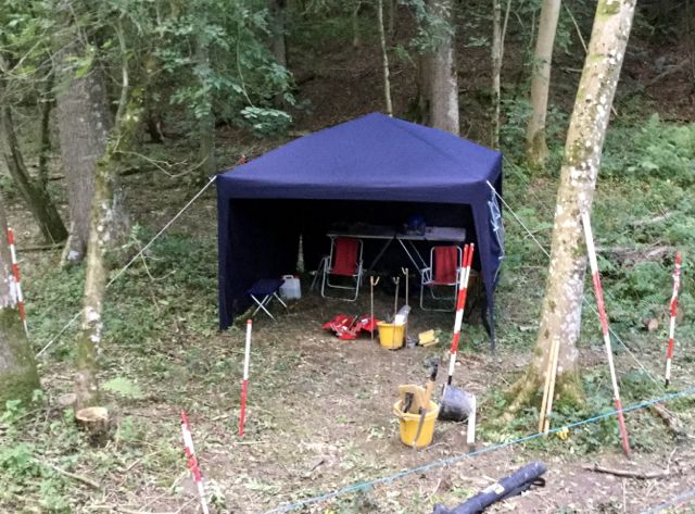
The final photograph before breaking camp, the gazebo in the woods plus an unmatched selection of ranging rods.